
Archived information
The Standard on Web Usability replaces this content. This content is archived because Common Look and Feel 2.0 Standards have been rescinded.
Archived information is provided for reference, research or recordkeeping purposes. It is not subject to the Government of Canada Web Standards and has not been altered or updated since it was archived.
|
|
Fisheries and Oceans Canada |
Pêches et Océans Canada |
|
 |
|||
| VOL. 38, MONTHLY EDITION NO 05 May 31, 2013 Publication Number 40063779 |
|||

Published Monthly by the
|
|||
|
CONTENTS |
|||
Page |
|||
| Section 1 |
Safety and General Information | 1 - 6 |
|
| Section 2 |
Chart Corrections | 7 - 18 |
|
| Section 3 |
Radio Aids to Marine Navigation Corrections | 19-21 |
|
| Section 4 |
Sailing Directions and Small Craft Guide Corrections | 22,23 |
|
| Section 5 |
List of Lights, Buoys and Fog signals Corrections | 24-29 |
|
Maritime Services Directorate Aids to Navigation |
|||
Fisheries and Oceans Canada - Official publication of the Canadian Coast Guard |
|||
EXPLANATORY NOTES |
Geographical positions refer directly to the graduations of the largest scale Canadian Hydrographic chart unless otherwise indicated. |
Bearings refer to the true compass and are measured clockwise from 000° (North) clockwise to 359°; those relating to lights are from seaward. |
Visibility of lights is that in clear weather. |
Depths - The units used for soundings (metres, fathoms or feet) are stated in the title of each chart. |
Elevations are normally given above Higher High Water, Large Tides unless otherwise indicated. |
Distances may be calculated as follows: |
1 nautical mile = 1 852 metres (6,076.1 feet) 1 statute mile = 1 609.3 metres (5,280 feet) 1 metre = 3.28 feet |
Temporary & Preliminary Notices are indicated by a (T) or a (P) before the chart action and in the section 1. Please note that Nautical charts are not amended by the Canadian Hydrographic Service for Temporary (T) and Preliminary (P) Notices. It is recommended that mariners chart these corrections in pencil. Listing of charts affected by Temporary and Preliminary Notices are revised and promulgated quarterly in Section 1 of the Monthly Edition . |
Please note that, in addition to the temporary and preliminary changes normally advertised as (T) and (P) Notices, there are a few permanent changes to navigational aids that have been advertised as Preliminary Notices to Mariners while charts are being updated for new editions. |
Marine Information Report & Suggestion Sheet - Mariners are requested to notify the responsible authorities when new or suspected dangers to navigation are discovered, changes observed in aids to navigation or corrections to publications are seen to be necessary. Such communications can be made using the Marine Information Report & Suggestion Sheet inserted on the last page of each monthly edition of Notices to Mariners. |
Canadian Hydrographic Service – Information Published in Section 2 Notices to Mariners - Mariners are advised that only the most critical changes that directly affect safety to navigation are issued in Chart Corrections - Section 2. This limitation is required to ensure that charts remain as clear and easy to read as possible. As a result, mariners may see minor discrepancies of a non-critical nature between information in official publications. For example, a small change in the nominal range or height of a light may not result in the production of a chart correction, in Notices to Mariners, but may result in a List of Light, Buoys and Fog Signals correction. |
| In case of discrepancy between information provided on CHS charts related to aids to navigation, and the List of Light publication, the latter shall be deemed as containing the most up to date information |
Canadian Nautical Charts & Publications - A source list of Canadian Nautical Charts & Publications is published in Notice No. 14 of the Notices to Mariners Annual Edition April 2011. The source supply and the prices effective at the time of printing are listed. For current chart edition dates refer to the following web site: http://www.chs-shc.gc.ca/charts-cartes/paper-papier/index-eng.asp |
NOTE: Cette publication est aussi disponible en français. |
CHART CORRECTIONS - SECTION 2 |
|
Corrections to nautical charts will be listed in numeric order by chart number. Each chart correction listed applies only to that particular chart. Related charts, if any, will have their own specific correction listed separately. Users should also refer to CHS Chart 1 Symbols, Abbreviations Terms for additional information pertaining to the correction of charts. The illustration below describes the elements that will comprise a typical Section 2 chart correction. |

ADVISORY |
|
NOTICES TO SHIPPING (WRITTEN AND BROADCAST) |
|
The Canadian Coast Guard is implementing a number of changes to the aids to navigation system in Canada . |
|
These changes are advertised as Notices to Shipping (Broadcast and Written) by the Canadian Coast Guard and are followed up with Notices to Mariners, then charts are updated by hand correction, reprints or new editions. |
|
Mariners are advised that all relevant Written Notices to Shipping should be kept until superseded by Notices to Mariners or through revised charts issued by the Canadian Hydrographic Service. |
|
Written Notices to Shipping are available on the Canadian Coast Guard Website at: www.ccg-gcc.gc.ca/eng/CCG/NOTSHIP. |
|
The Canadian Hydrographic Service is reviewing the impact of these changes with the Canadian Coast Guard and together we are preparing an action plan on the issuing of chart revisions. |
|
For further information contact your local Regional Notices to Shipping (NOTSHIP) issuing authorities. |
|
|

| MONTHLY EDITION OF NOTICES TO MARINERS |
WEB ACCESS |
We are offering a feature where subscribers to our on-line service are able to receive the complete electronic monthly edition of our Notices to Mariners. We are encouraging our clients to visit the http://www.notmar.gc.ca/subscribe/ web site to subscribe for this service. Users wishing to receive information updates for their charts can do so by setting up a 'User Profile' on the following web page http://www.notmar.gc.ca/search/mycharts-eng.php?czoxOToibnRtPXN0ZXBfb25lJmxhbmc9ZSI7 This feature permits users to register the nautical charts they currently have in their possession. Registrants are then automatically notified by e-mail when a Notice to Mariners is published concerning these charts. |
INDEX |
|
CANADIAN HYDROGRAPHIC SERVICE - ANNOUNCEMENT REGARDING CANADIAN HYDROGRAPHIC SERVICE CHART PATCHES |
1 |
CANADIAN HYDROGRAPHIC SERVICE - CUMULATIVE CHART CORRECTIONS |
1 |
CANADIAN HYDROGRAPHIC SERVICE - Current chart edition dates |
1 |
CANADIAN HYDROGRAPHIC SERVICE - PRINT ON DEMAND CHARTS - CARE AND USE |
1 |
CANADIAN HYDROGRAPHIC SERVICE - TRANSPORT CANADA NAVIGATION SAFETY - ECDIS |
1 |
*501 CANADIAN HYDROGRAPHIC SERVICE - NAUTICAL CHARTS |
2 |
*502 CANADIAN HYDROGRAPHIC SERVICE - ELECTRONIC NAVIGATIONAL CHARTS |
2 |
*503 CANADIAN HYDROGRAPHIC SERVICE - RASTER DIGITAL CHARTS (BSB V4) |
3 |
*504 CANADIAN COAST GUARD - MARINE COMMUNICATION AND TRAFIC SERVICES - The International Hydrographic Organization's World-Wide Navigational Warning Service |
3 |
*505 Saguenay-St. Lawrence Marine Park - Whale protection |
3 |
*506 CANADIAN COAST GUARD PUBLICATIONS - NEW EDITION OF RADIO AIDS TO MARINE NAVIGATION (ATLANTIC, ST. LAWRENCE, GREAT LAKES, LAKE WINNIPEG AND EASTERN ARCTIC) - 2013 |
4 |
*507 CANADIAN COAST GUARD PUBLICATIONS - NEW EDITION OF RADIO AIDS TO MARINE NAVIGATION (PACIFIC AND WESTERN ARCTIC) - 2013 |
4 |
*508 CANADIAN COAST GUARD PUBLICATION - new edition of THE Annual Edition of Notices to Mariners - 2013 |
4 |
*509 Halifax Harbour - Bedford Basin - Measured Daybeacons to be discontinued |
5 |
*510 Annapolis Basin - Light Buoy to be discontinued |
5 |
*511 Lac Saint-Pierre - new private buoys |
6 |
*512 Berens River to / à Nelson River - LIGHT STRUCTURE REPLACED |
6 |
*513 HUDSON STRAIT AND BAY - BROOMFIELD ISLAND - RACON REMAIN IN POSITION |
6 |
*514 HUDSON STRAIT AND BAY - NOTTINGHAM ISLAND - RACON REMAIN IN POSITION |
6 |
*515 Simpson Strait - Changes to fixed and floating aids configuration completed |
6 |
*516 CANADIAN COAST GUARD PUBLICATION - AMENDMENT TO THE RADIO AIDS TO MARINE NAVIGATION (ATLANTIC, ST. LAWRENCE, GREAT LAKES, LAKE WINNIPEG AND EASTERN ARCTIC) PUBLICATION - 2013 - REGIONAL NOTICES TO SHIPPING (NOTSHIP) ISSUING AUTHORITIES amendment |
19 |
*517 CANADIAN COAST GUARD PUBLICATION - RADIO AIDS TO MARINE NAVIGATION (ATLANTIC, ST. LAWRENCE, GREAT LAKES, LAKE WINNIPEG AND EASTERN ARCTIC) PUBLICATION - 2013 -Facility Information amendment |
19 |
*518 CANADIAN COAST GUARD PUBLICATION - RADIO AIDS TO MARINE NAVIGATION (ATLANTIC, ST. LAWRENCE, GREAT LAKES, LAKE WINNIPEG AND EASTERN ARCTIC) PUBLICATION - 2013 -Facility Information amendment |
20 |
*519 CANADIAN COAST GUARD PUBLICATION - RADIO AIDS TO MARINE NAVIGATION (ATLANTIC, ST. LAWRENCE, GREAT LAKES, LAKE WINNIPEG AND EASTERN ARCTIC) PUBLICATION - 2013 - General Procedures - INSPECTION OF RADIO amendment APPARATUS |
20 |
*520 CANADIAN COAST GUARD PUBLICATION - RADIO AIDS TO MARINE NAVIGATION (ATLANTIC, ST. LAWRENCE, GREAT LAKES, LAKE WINNIPEG AND EASTERN ARCTIC) PUBLICATION - 2013 - General Procedures - Ship Radio Inspection Contacts amendment |
21 |
|
NUMERICAL INDEX OF CANADIAN CHARTS AFFECTED |
|||||
|
Chart No. |
Page |
Chart No. |
Page |
Chart No. |
Page |
|
1202 |
7 |
4841 |
13 |
|
|
|
1209 |
7 |
4862 |
13 |
|
|
|
1220 |
7 |
5449 |
6 |
|
|
|
1310 |
8 |
5640 |
14 - 17 |
|
|
|
1430 |
8 |
5707 |
6 |
|
|
|
1438 |
9 |
6241 |
6, 17 |
|
|
|
2006 |
9 |
6270 |
17 |
|
|
|
2064 |
9 |
6272 |
18 |
|
|
|
2069 |
9 |
7736 |
6 |
|
|
|
2308 |
10 |
8012 |
18 |
|
|
|
3411 |
2 |
|
|
|
|
|
3736 |
2 |
|
|
|
|
|
3908 |
2 |
|
|
|
|
|
4010 |
10 |
|
|
|
|
|
4011 |
10 |
|
|
|
|
|
4012 |
11 |
|
|
|
|
|
4049 |
11 |
|
|
|
|
|
4201 |
5 |
|
|
|
|
|
4337 |
11 |
|
|
|
|
|
4379 |
12 |
|
|
|
|
|
4396 |
5 |
|
|
|
|
|
4468 |
12 |
|
|
|
|
|
4469 |
12 |
|
|
|
|
|
4483 |
13 |
|
|
|
|
|
4622 |
13 |
|
|
|
|
|
4659 |
13 |
|
|
|
|
CANADIAN HYDROGRAPHIC SERVICE - ANNOUNCEMENT REGARDING CANADIAN HYDROGRAPHIC SERVICE CHART PATCHES
Colour Web Patches are free to the mariner, and given the quality of many printers, should reproduce well. They will be available in real time all around the world.
CHS welcomes your feedback on this service at chsinfo@dfo-mpo.gc.ca
CANADIAN HYDROGRAPHIC SERVICE - CUMULATIVE CHART CORRECTIONS
The cumulative Notices to Mariners corrections for charts can now be accessed at
www.notmar.gc.ca/search/notmar-eng.php
CANADIAN HYDROGRAPHIC SERVICE - Current chart edition dates
|
CHART EDITIONS |
|
The three terms described below are used to indicate the publication status of Canadian charts. |
|
NEW CHART - "NEWCHT" |
|
The first publication of a Canadian chart embracing an area not previously charted to the scale shown, or embracing an area different from any existing Canadian chart. |
|
NEW EDITION - "NEWEDT" |
|
A new issue of an existing chart containing amendments essential to navigation in addition to those issued in Notices to Mariners and making existing editions obsolete. |
|
REPRINTS |
|
A new issue of the current edition of a chart incorporating no amendments of navigational significance other than those previously promulgated in Notices to Mariners. It may also contain amendments from other sources provided they are not essential to navigation. Previous printings of the current edition remain in force. |
The current chart edition dates can be accessed at www.chs-shc.gc.ca/charts-cartes/paper-papier/index-eng.asp
CANADIAN HYDROGRAPHIC SERVICE - PRINT ON DEMAND CHARTS - CARE AND USE
|
Background
By providing nautical charts to the public, the goal of the Canadian Hydrographic Service (CHS) is to provide services for safe navigation in a fiscally responsible manner. As a result, CHS continues to expand its portfolio of nautical paper charts that are printed using Print On Demand (POD) technology. These charts are easily recognized by their whiter paper and the coloured logo of the Canadian Hydrographic Service. This new technology enables CHS to print charts in a more efficient manner while enhancing chart content through being able to quickly add new and important information. POD technology provides customers with up-to-date charts without the historical hand-drawn corrections or glued-on patches. Additionally, this technology eliminates out-of-stock situations which arise with the traditional printing and warehousing methods. In the event of a national emergency, CHS can respond to the appropriate authorities with best available information very quickly.
Care of Your POD Chart
CHS encourages its customers to handle the POD charts more carefully than the traditional lithographic charts. When plotting information on POD charts, use HB pencils and apply limited pressure. Testing has suggested that an Indian gum eraser is more effective than alternatives when used on the product. This eraser is also suitable for charts printed using lithographic processes. |
CANADIAN HYDROGRAPHIC SERVICE - TRANSPORT CANADA NAVIGATION SAFETY - ECDIS
|
Mariners are advised that ECDIS may not display some isolated shoal depths when operating in "base or standard display" mode. Route planning and monitoring alarms for these shoal depths may not always be activated. To ensure safe navigation and to confirm that a planned route is clear of such dangers, mariners should visually inspect the planned route and any deviations from it using ECDIS configured to display "all data". The automated voyage planning check function should not be solely relied upon. |
*501 CANADIAN HYDROGRAPHIC SERVICE - NAUTICAL CHARTS
|
CHARTS |
MAIN TITLE |
SCALE |
PUBLISHED |
CAT# |
PRICE |
|
|
New Charts |
|
|||||
|
3908 |
Kitimat Harbour |
1:15000 |
15-MAR-2013 |
2 |
15.00 |
|
|
New Editions |
All temporary and preliminary notices affecting the previous versions of the following chart(s) (is / are) now cancelled. For any outstanding notices please consult section 2 of this edition. |
|||||
|
3411 |
Sooke |
1:12000 |
15-MAR-2013 |
2 |
15.00 |
|
|
Charts Permanently Withdrawn |
All temporary and preliminary notices affecting the previous versions of the following chart(s) (is / are) now cancelled. For any outstanding notices please consult section 2 of this edition. |
|||||
|
3736 |
Kitimat |
|
||||
*502 CANADIAN HYDROGRAPHIC SERVICE - ELECTRONIC NAVIGATIONAL CHARTS
|
NEW PRODUCTS |
|
|
S-57 ENC NUMBER |
CHART TITLE |
|
CA273428 |
Prince of Wales Strait, Northern Portion/ Partie Nord |
|
CA273432 |
Nansen Sound and Greely Fiord |
|
CA273433 |
Jones Sound,Norwegion Bay and Queens Channel |
|
CA273434 |
Bathurst Island to/à Borden Island |
|
CA273435 |
Cape Stallworth to Cape Discovery |
|
CA373417 |
Cape Prince of Wales to Davies Island |
|
CA373429 |
Princess Royal Islands |
|
CA376024 |
St. Marys Bay |
|
CA376309 |
St. Mary's Bay (Continuation A) |
|
CA476027 |
Grand Passage |
|
CA476028 |
Petit Passage |
|
CA576026 |
East Sandy Cove |
|
CA576499 |
Weymouth |
|
CA576500 |
Meteghan |
|
CA576501 |
Saulnierville |
|
CA579109 |
Sorel au/to Ruisseau Lahaise |
|
CA579110 |
Ruisseau Lahaise to/à Saint-Antoine-Sur-Richelieu |
|
CA579111 |
Saint-Antoine-Sur-Richelieu to/à Île Aux Cerfs |
|
WITHDRAWN PRODUCTS |
|
|
CA470139 |
Tsibass Lagoon |
|
CA470140 |
Nepah Lagoon - Continuation B |
|
CA470267 |
Head of/Fond de Toba Inlet |
*503 CANADIAN HYDROGRAPHIC SERVICE - RASTER DIGITAL CHARTS (BSB V4)
|
CHARTS |
MAIN TITLE |
SCALE |
PUBLISHED |
|
New Editions |
All temporary and preliminary notices affecting the previous versions of the following chart(s) (is / are) now cancelled. For any outstanding notices please consult section 2 of this edition. |
||
|
R/M3495 |
Vancouver Harbour Eastern Portion/Partie Est |
1:30000 |
14-DEC-2012 |
The International Hydrographic Organization's World-Wide Navigational Warning Service (WWNWS) is conducting a survey concerning the quality of maritime safety information broadcast via SafetyNet and NAVTEX to identify measures to improve service. It provides an opportunity to comment on the quality of the content and reception of Navigational Warnings provided by each NAVAREA Coordinator. Please visit HTTP://WWW.SURVEYMONKEY.COM/S/IHO_SURVEY (no longer active) to complete the short survey.
The World Meteorological Organization offers a similar survey regarding the World-Wide Meteorological Information and Warning Service available at: WWW.JCOMM.INFO/MMMS. Your participation is greatly appreciated and valued.
(MCTS)
*505 Saguenay-St. Lawrence Marine Park - Whale protection
Whale protection in and around the Saguenay-St. Lawrence Marine Park
The waters in and around the Saguenay-St. Lawrence Marine Park are well known for their resident beluga population and the wide diversity of whales that migrate there to feed, particularly between April and November.
Regulatory protection measures
All whale species that are found in the St. Lawrence Estuary are protected under the Marine Mammal Regulations, pursuant to the Fisheries Act. Within the boundaries of the Saguenay-St. Lawrence Marine Park, specific measures are set out in the Marine Activities in the Saguenay-St. Lawrence Marine Park Regulations (see section 5C of the Annual Edition of the Notices to Mariners - April 2013 to March 2014). Any collision with a marine mammal within the Marine Park must immediately be reported to a park warden at 1-866-508-9888. For collisions that occur outside the Marine Park or for any situation involving a marine mammal that is dead or in trouble, contact the emergency network at 1-877-722-5346 or on channel 16.
Voluntary protection measures
Provisional mesures in effect from June 1 to October 31, 2013
These measures apply to merchant vessels and cruise ships transiting between pointe à Boisvert and cap de la Tête au Chien (see map below) to prevent collisions with whales. These measures should only be taken when they will not jeopardize navigational safety.
Caution area (yellow area): Heightened vigilance is critical for navigators transiting in this area to reduce the risk of collisions with whales. Posting a lookout is recommended in order to increase the chances of seeing the whales and thus taking necessary measures to avoid them. If bypassing the whales is not possible, slow down and wait for the animals to move away to a distance greater than 400 meters (0.215 nautical miles) before resuming original speed. It is more difficult to see the animals at night: increased caution is recommended.
Slowdown to 10 knots area (red area): It is recommended that vessels navigate in the Laurentian Channel, post a lookout, and slow down to a maximum speed over water of 10 knots when transiting the slowdown area.
Area to be avoided (hatched red area): To reduce noise and risks of collisions with whales, vessels should avoid transiting through this area that is highly frequented by blue whales, an endangered species. If it is necessary to pass through the area, slow down to a maximum speed over water of 10 knots.
See attached diagram:
http://www.notmar.gc.ca/eng/services/notmar/sec1may13emesures_provisoire.png
The 2013 edition of Radio Aids to Marine Navigation (Atlantic, St. Lawrence, Great Lakes, Lake Winnipeg and Eastern Arctic) is now available for download, free of charge, on the Radio Aids to Marine Navigation website: www.ccg-gcc.gc.ca/eng/CCG/MCTS_Radio_Aids.
Paper copies of the publication will no longer be sold.
Amendments to this publication are advertised by radio broadcast (Notices to Shipping) and/or in Section 3 of the monthly edition of Notices to Mariners ( www.notmar.gc.ca).
The 2013 edition has been revised to December 31, 2012 and supersedes the 2012 edition.
*507 CANADIAN COAST GUARD PUBLICATIONS - NEW EDITION OF RADIO AIDS TO MARINE NAVIGATION (PACIFIC AND WESTERN ARCTIC) - 2013
The 2013 edition of Radio Aids to Marine Navigation (Pacific and Western Arctic) is now available for download, free of charge, on the Radio Aids to Marine Navigation website: www.ccg-gcc.gc.ca/eng/CCG/MCTS_Radio_Aids.
Paper copies of the publication will no longer be sold.
Amendments to this publication are advertised by radio broadcast (Notices to Shipping) and/or in Section 3 of the monthly edition of Notices to Mariners (www.notmar.gc.ca).
The 2013 edition has been revised to December 31, 2012 and supersedes the 2012 edition.
The 2013 edition of the Annual Edition of Notices to Mariners publication is now available for download, free of charge, on the NOTMAR web site at http://www.notmar.gc.ca/go.php?doc=eng/services/annual/default-eng.
Paper copies of the publication will no longer be sold.
Amendments to this publication are advertised in the Section 1 of the monthly edition of Notices to Mariners www.notmar.gc.ca.
The 2013 edition has been revised up to Edition 12, 2012 and supersedes the 2012 edition
*509 Halifax Harbour - Bedford Basin - Measured Daybeacons to be discontinued
Reference: Chart : 4201
The Canadian Coast Guard proposes to permanently discontinue the following aids to navigation:
Sherwood Point Measured Mile Day Beacon (44° 40 48'.36"N 63° 39' 07"W)
Princess Lodge Measured Mile Day beacon (44° 41 44'.00"N 63° 39' 37.1"W)
Comments on this action are solicited from mariners and other interested parties.
Comments should be directed to the following within three months from the date of this notice:
Regional Superintendent,
Aids to Navigation,
Canadian Coast Guard,
PO Box 5667,
St. John's, Newfoundland, A1C 5X1
Telephone: 709-772-5195,
Any objections raised must state the facts on which they are based and should include supporting information on safety, commerce and public benefit.
(F2013-007)
*510 Annapolis Basin - Light Buoy to be discontinued
Reference: Chart : 4396
The Canadian Coast Guard proposes to permanently discontinue the following aid to navigation:
Digby Pier light buoy V6, LL 206 (44°37'34.5"N 65°45'03.8"W)
Comments on this action are solicited from mariners and other interested parties.
Comments should be directed to the following within three months from the date of this notice:
Regional Superintendent,
Aids to Navigation,
Canadian Coast Guard,
PO Box 5667,
St. John's, Newfoundland, A1C 5X1
Telephone: 709-772-5195,
Any objections raised must state the facts on which they are based and should include supporting information on safety, commerce and public benefit.
(F2013-006)
*511 Lac Saint-Pierre - new private buoys
The following private buoys have been established in Chenal du Moine:
White and orange light buoy, Fl Y 4s, marked "01" (46°03'54.3"N 73°01'34.74"W)
White and orange light buoy, Fl Y 4s, marked "02" (46°04'29.52"N 72°58'40.2"W)
White and orange light buoy, Fl Y 4s, marked "03" (46°04'46.74"N 72°58'9.3"W)
White and orange light buoy, Fl Y 4s, marked "04" (46°05'21.06"N 72°57'40.86"W)
White and orange light buoy, Fl Y 4s, marked "05" (46°05'17.82"N 72°57'33.36"W)
White and orange light buoy, Fl Y 4s, marked "06" (46°05'12.9"N 72°57'21.6"W)
White and orange light buoy, Fl Y 4s, marked "07" (46°06'24.9"N 72°59'30.3"W)
The following private buoys have been established in Chenal aux Corbeaux :
White and orange light buoy, Fl Y 4s, marked "08" (46°06'11.7"N 73°00'19.2"W)
White and orange light buoy, Fl Y 4s, marked "09" (46°03'51.9"N 73°00'33.54"W)
White and orange light buoy, Fl Y 4s, marked "10" (46°06'04.62"N 73°00'10.8"W)
White and orange light buoy, Fl Y 4s, marked "11" (46°05'26.82"N 73°01'09.9"W)
White and orange light buoy, Fl Y 4s, marked "12" (46°04'56.64"N 73°01'43.68"W)
White and orange light buoy, Fl Y 4s, marked "13" (46°04'35.94"N 73°02'10.2"W)
White and orange light buoy, Fl Y 4s, marked "14" (46°03'49.26"N 73°01'11.7"W)
White and orange light buoy, Fl Y 4s, marked "15" (46°04'10.8"N 72°59'26.4"W)
(Q2013-014-029)
*512 Berens River to / à Nelson River - LIGHT STRUCTURE REPLACED
Reference: Notice 108(P)/2010 is now cancelled. (Chart 6241)
(A2013-006)
*513 HUDSON STRAIT AND BAY - BROOMFIELD ISLAND - RACON REMAIN IN POSITION
Reference: Notice 807(P) /2004 is now cancelled. (Chart 5707)
(Edn 5 2013)
*514 HUDSON STRAIT AND BAY - NOTTINGHAM ISLAND - RACON REMAIN IN POSITION
Reference: Notice 808(P) /2004 is now cancelled. (Chart 5449)
(Edn 5 2013)
*515 Simpson Strait - Changes to fixed and floating aids configuration completed
Reference: Notice 214(P) /2012 is now cancelled. (Chart: 7736)
(Edn 5 2013)
1202 - Cap à l'Est à St-Fulgence - Continuation A - New Edition - 22-JUL-2011 - NAD 1983
|
24-MAY-2013 |
|
|
LNM/D. 07-DEC-2012 |
|
Delete |
orange beacon BnOr
|
|
48°26'37.2"N 070°54'00.5"W |
|
|
|||
|
|
This notice affects Electronic Navigational Chart: CA479094, CA579077 |
||
|
(Q2013039) DFO(6408798-01) |
|||
|
|
|||
1209 - Saint-Fulgence à/to Rivière Shipshaw - New Edition - 14-DEC-1984 - NAD 1927
|
24-MAY-2013 |
|
|
LNM/D. 25-NOV-2011 |
|
Delete |
beacon Bn
|
|
48°26'37.0"N 070°54'02.1"W |
|
|
|||
|
|
This notice affects Electronic Navigational Chart: CA479094, CA579077 |
||
|
(Q2013039) DFO(6408798-01) |
|||
|
|
|||
1220 - Baie des Sept-Îles - New Edition - 11-MAY-2012 - NAD 1983
|
24-MAY-2013 |
|
|
LNM/D. 22-FEB-2013 |
|
Affix |
patch |
|
50°09'58.5"N 066°28'15.2"W |
|
|
|||
|
|
Download Patch - http://www.chs-shc.gc.ca/patches/1220PA_20130422_02.pdf |
||
|
|
|||
|
|
This notice affects Electronic Navigational Chart: CA479006, CA579007 |
||
|
DFO(6408804-01) |
|||
|
|
|||
1220 - Pointe-Noire - New Edition - 11-MAY-2012 - NAD 1983
|
24-MAY-2013 |
|
|
LNM/D. 22-FEB-2013 |
|
Affix |
patch |
|
50°09'58.5"N 066°28'15.2"W |
|
|
|||
|
|
Download Patch - http://www.chs-shc.gc.ca/patches/1220PA_20130422_01.pdf |
||
|
|
|||
|
|
This notice affects Electronic Navigational Chart: CA479006, CA579007 |
||
|
DFO(6408804-01) |
|||
|
|
|||
1310 - Section B-C - New Edition - 15-FEB-2008 - NAD 1983
|
31-MAY-2013 |
|
|
LNM/D. 19-APR-2013 |
|
|
Add |
limit of dredged channel
|
|
between 45°32'14.2"N 073°32'17.0"W |
|
|
|
|
|
and 45°32'09.5"N 073°32'06.1"W |
|
|
|
||||
|
|
This notice affects Electronic Navigational Chart: CA579080 |
|||
|
DFO(6408753-01) |
||||
|
Add |
limit of dredged channel
|
|
between 45°33'31.2"N 073°31'06.9"W |
|
|
|
|
|
and 45°33'40.1"N 073°30'55.2"W |
|
|
|
||||
|
|
This notice affects Electronic Navigational Chart: CA579080 |
|||
|
DFO(6408753-02) |
||||
|
Add |
10,8 m
|
|
45°32'56.0"N 073°31'32.0"W |
|
|
|
||||
|
|
This notice affects Electronic Navigational Chart: CA579080 |
|||
|
DFO(6408753-03) |
||||
|
|
||||
1430 - Lac Saint-Louis - New Chart - 16-APR-2010 - NAD 1983
|
03-MAY-2013 |
|
|
LNM/D. 01-MAR-2013 |
|
|
Add |
green port hand spar buoy, marked AM33
|
|
45°21'20.6"N 073°59'22.3"W |
|
|
|
||||
|
|
This notice affects Electronic Navigational Chart: CA479228 |
|||
|
(Q2013034) DFO(6408794-01) |
||||
|
Add |
obstruction with known depth of 10 metres 0 decimetres
|
|
45°21'12.2"N 073°51'22.8"W |
|
|
|
||||
|
|
This notice affects Electronic Navigational Chart: CA479228 |
|||
|
DFO(6408799-01) |
||||
|
|
||||
1438 - Grindstone Island to/à Carleton Island - New Edition - 31-AUG-2012 - World Geodetic System 1984
|
10-MAY-2013 |
|
|
|
|
Delete |
date "2012-01-01" from the line reading Corrected to NOTICE TO MARINERS/Corrigée jusqu'à L'AVIS AUX NAVIGATEURS in the Edition/Notice block in the lower left hand corner of the chart border.
|
|
in lower left hand corner of the chart border |
|
DFO(6603866-01) |
|||
|
|
|||
2006 - Upper Gap to/à Telegraph Narrows - New Edition - 31-MAR-2000 - NAD 1983
|
31-MAY-2013 |
|
|
LNM/D. 29-OCT-2010 |
|
|
Add |
sounding of 5 feet, Rep (2010)
|
|
44°10'11.2"N 077°03'46.3"W |
|
|
|
||||
|
|
This notice affects Electronic Navigational Chart: CA373063, CA473277 |
|||
|
DFO(6603868-02) |
||||
|
|
||||
2064 - Kingston to/à False Duck Islands - New Edition - 05-MAR-1999 - NAD 1983
|
31-MAY-2013 |
|
|
LNM/D. 12-OCT-2012 |
|
Delete |
sounding of 1 1/2 fathoms
|
|
44°10'11.0"N 077°03'45.0"W |
|
|
|||
|
|
This notice affects Electronic Navigational Chart: CA373063 |
||
|
DFO(6603868-01) |
|||
|
Add |
sounding of 3/4 fathoms, Rep (2010)
|
|
44°10'11.2"N 077°03'46.3"W |
|
|
|||
|
|
This notice affects Electronic Navigational Chart: CA373063, CA473277 |
||
|
DFO(6603868-02) |
|||
|
|
|||
2069 - Picton to/à Presqu'île Bay - New Edition - 19-MAY-2000 - NAD 1983
|
31-MAY-2013 |
|
|
LNM/D. 29-OCT-2010 |
|
|
Add |
sounding of 5 feet, Rep (2010)
|
|
44°10'11.2"N 077°03'46.3"W |
|
|
|
||||
|
|
This notice affects Electronic Navigational Chart: CA373063, CA473277 |
|||
|
DFO(6603868-02) |
||||
|
|
||||
2308 - Michipicoten Island to/à Oiseau Bay - New Edition - 22-SEP-2006 - NAD 1983
|
31-MAY-2013 |
|
|
LNM/D. 02-MAY-2008 |
|
|
Add |
dangerous underwater rock with depth of 3 1/4 fathoms, Rep (2010)
|
|
48°15'37.6"N 086°10'19.2"W |
|
|
|
||||
|
|
This notice affects Electronic Navigational Chart: CA373072 |
|||
|
DFO(6603869-01) |
||||
|
|
||||
4010 - Bay of Fundy / Baie de Fundy (Inner portion / partie intérieure) - New Edition - 14-FEB-2003 - NAD 1983
|
24-MAY-2013 |
|
|
LNM/D. 10-AUG-2012 |
|
Amend |
FlG 6s 125ft 11M to read FlG 6s 134ft 10M (Priv)
|
|
45°35'47.0"N 064°46'55.7"W |
|
|
|||
|
|
This notice affects Electronic Navigational Chart: CA276241 |
||
|
(F2013002) LL(157) DFO(6306365-01) |
|||
|
|
|||
4011 - Approaches to/Approches à Bay of Fundy/Baie de Fundy - New Edition - 03-JAN-2003 - NAD 1983
|
17-MAY-2013 |
|
|
LNM/D. 15-MAR-2013 |
|
|
Delete |
depth of 128 metres over artificial feature
|
|
43°02'07.0"N 065°46'04.6"W |
|
|
|
||||
|
|
This notice affects Electronic Navigational Chart: CA276206, CA276800 |
|||
|
DFO(6306359-01) |
||||
|
Delete |
private yellow lighted spar buoy Fl(5) Y 20s
|
|
43°02'19.3"N 065°46'04.6"W |
|
|
|
||||
|
|
This notice affects Electronic Navigational Chart: CA276206, CA276800 |
|||
|
DFO(6306359-02) |
||||
|
Delete |
private yellow lighted spar buoy Fl(5) Y 20s
|
|
43°02'01.1"N 065°46'50.2"W |
|
|
|
||||
|
|
This notice affects Electronic Navigational Chart: CA276206, CA276800 |
|||
|
DFO(6306359-03) |
||||
|
|
||||
4012 - Yarmouth to/à Halifax - New Edition - 14-FEB-2003 - NAD 1983
|
17-MAY-2013 |
|
|
LNM/D. 08-FEB-2013 |
|
Delete |
depth of 128 metres over artificial feature
|
|
43°02'07.0"N 065°46'04.6"W |
|
|
|||
|
|
This notice affects Electronic Navigational Chart: CA276206, CA276800 |
||
|
DFO(6306359-01) |
|||
|
Delete |
private yellow lighted spar buoy Fl(5) Y 20s
|
|
43°02'19.3"N 065°46'04.6"W |
|
|
|||
|
|
This notice affects Electronic Navigational Chart: CA276206, CA276800 |
||
|
DFO(6306359-02) |
|||
|
Delete |
private yellow lighted spar buoy Fl(5) Y 20s
|
|
43°02'01.1"N 065°46'50.2"W |
|
|
|||
|
|
This notice affects Electronic Navigational Chart: CA276206, CA276800 |
||
|
DFO(6306359-03) |
|||
|
|
|||
4049 - Grand Bank, Northern Portion Grand Banc, Partie Nord to/à Flemish Pass/Passe Flamande - New Edition - 19-MAY-1995 - NAD 1983
|
03-MAY-2013 |
|
|
LNM/D. 05-APR-2013 |
|
Delete |
suspended well with depth over wellhead unknown
|
|
46°36'14.0"N 047°57'54.0"W |
|
|
|||
|
|
This notice affects Electronic Navigational Chart: CA276101 |
||
|
DFO(6306349-01) |
|||
|
|
|||
4337 - Alma (and Approaches/et les Approaches) - New Edition - 07-JUN-2002 - NAD 1983
|
24-MAY-2013 |
|
|
|
|
|
Amend |
FlG 6s 125ft 11M to read FlG 6s 134ft 10M (Priv)
|
|
45°35'38.1"N 064°46'47.7"W |
|
|
|
||||
|
|
This notice affects Electronic Navigational Chart: CA276241 |
|||
|
(F2013002) LL(157) DFO(6306365-01) |
||||
|
|
||||
4379 - Liverpool Harbour - New Edition - 18-JUL-2003 - NAD 1983
|
17-MAY-2013 |
|
|
LNM/D. 21-SEP-2012 |
|
Replace |
depth of 13 feet with depth of 11 feet
|
|
44°02'41.8"N 064°42'38.8"W |
|
DFO(6306341-01) |
|||
|
Replace |
depth of 13 feet with depth of 11 feet
|
|
44°02'33.4"N 064°42'50.1"W |
|
DFO(6306341-02) |
|||
|
Replace |
depth of 11 feet with depth of 8 feet
|
|
44°02'37.0"N 064°42'39.1"W |
|
DFO(6306341-03) |
|||
|
Delete |
depth of 7 feet
|
|
44°02'31.0"N 064°42'58.3"W |
|
DFO(6306341-04) |
|||
|
Add |
depth of 5 feet
|
|
44°02'30.8"N 064°42'58.6"W |
|
DFO(6306341-05) |
|||
|
Add |
depth of 5 feet
|
|
44°02'26.5"N 064°42'59.1"W |
|
DFO(6306341-06) |
|||
|
|
|||
4468 - Havre de Harrington - New Edition - 12-JUL-1985 - NAD 1927
|
03-MAY-2013 |
|
|
LNM/D. 01-FEB-2013 |
|
Amend |
Fl G 6s48ft to read Fl G 6s58ft against light
|
|
50°28'13.5"N 059°27'29.2"W |
|
(Q2012150) LL(1558.7) DFO(6408752-01) |
|||
|
|
|||
4468 - Île du Petit Mécatina aux/to Îles Sainte-Marie - New Edition - 12-JUL-1985 - NAD 1927
|
03-MAY-2013 |
|
|
LNM/D. 01-FEB-2013 |
|
Amend |
Fl G 6s48ft to read Fl G 6s58ft against light
|
|
50°28'13.5"N 059°27'29.2"W |
|
(Q2012150) LL(1558.7) DFO(6408752-01) |
|||
|
|
|||
4469 - Île Plate à/to Île du Petit Mécatina - New Edition - 08-NOV-1985 - NAD 1927
|
03-MAY-2013 |
|
|
LNM/D. 01-FEB-2013 |
|
Amend |
Fl G 6s48ft to read Fl G 6s58ft against light
|
|
50°28'13.5"N 059°27'29.3"W |
|
(Q2012150) LL(1558.7) DFO(6408752-01) |
|||
|
|
|||
4483 - Caribou Harbour - New Edition - 10-JAN-2003 - NAD 1983
|
24-MAY-2013 |
|
|
LNM/D. 11-MAR-2011 |
|
Delete |
Channel Buoyed / Chenal balisé |
|
45°43'59.1"N 062°39'48.5"W |
|
DFO(6306360-01) |
|||
|
|
|||
4622 - Cape St. Mary's to/à Argentia Harbour and/et Jude Island - New Edition - 03-OCT-2003 - NAD 1983
|
24-MAY-2013 |
|
|
LNM/D. 09-DEC-2011 |
|
Add |
depth of 3 fathoms, 1 foot
|
|
47°01'08.1"N 054°09'35.8"W |
|
DFO(6306361-01) |
|||
|
Delete |
depth of 9 fathoms, 5 feet
|
|
47°01'06.0"N 054°09'39.8"W |
|
DFO(6306361-02) |
|||
|
|
|||
4659 - Port au Port - New Edition - 01-AUG-2003 - NAD 1983
|
03-MAY-2013 |
|
|
LNM/D. 31-DEC-2010 |
|
Affix |
patch |
|
48°42'00.0"N 058°40'00.0"W |
|
|
|||
|
|
Download Patch - http://www.chs-shc.gc.ca/patches/4659PA_20130325.pdf |
||
|
DFO(6306350-01) |
|||
|
|
|||
4841 - Cape St Mary's to/à Argentia - New Chart - 19-MAY-1989 - NAD 1983
|
24-MAY-2013 |
|
|
LNM/D. 09-DEC-2011 |
|
|
Add |
depth of 5 metres, 8 decimetres
|
|
47°01'08.1"N 054°09'35.8"W |
|
|
DFO(6306361-01) |
||||
|
|
||||
4862 - Carmanville to/à Bacalhoa Island and/et Fogo - New Chart - 26-DEC-2003 - NAD 1983
|
17-MAY-2013 |
|
|
LNM/D. 20-JUL-2012 |
|
Reposition |
red starboard hand lighted spar buoy FlR, marked DCB2
|
|
from 49°37'12.8"N 054°33'47.6"W |
|
|
|
|
to 49°37'11.2"N 054°33'54.7"W |
|
|
|||
|
|
This notice affects Electronic Navigational Chart: CA476814 |
||
|
(N2012-019) DFO(6306358-01) |
|||
|
|
|||
5640 - Churchill Harbour - New Edition - 17-JUN-2005 - NAD 1983
|
10-MAY-2013 |
|
|
LNM/D. 04-DEC-2009 |
|
|
Delete |
depth of 10 metres
|
|
58°47'20.8"N 094°12'45.2"W |
|
|
|
||||
|
|
This notice affects Electronic Navigational Chart: CA573227 |
|||
|
DFO(6603864-01) |
||||
|
Add |
depth of 9.6 metres
|
|
58°47'20.5"N 094°12'45.0"W |
|
|
|
||||
|
|
This notice affects Electronic Navigational Chart: CA573227 |
|||
|
DFO(6603864-02) |
||||
|
Add |
depth of 11.4 metres
|
|
58°47'09.5"N 094°12'56.7"W |
|
|
|
||||
|
|
This notice affects Electronic Navigational Chart: CA573227 |
|||
|
DFO(6603864-03) |
||||
|
Delete |
depth of 8.6 metres
|
|
58°47'07.7"N 094°12'49.3"W |
|
|
|
||||
|
|
This notice affects Electronic Navigational Chart: CA573227 |
|||
|
DFO(6603864-04) |
||||
|
Add |
depth of 8.3 metres
|
|
58°47'07.3"N 094°12'49.4"W |
|
|
|
||||
|
|
This notice affects Electronic Navigational Chart: CA573227 |
|||
|
DFO(6603864-05) |
||||
|
Add |
depth of 1.1 metres
|
|
58°46'52.0"N 094°12'57.2"W |
|
|
|
||||
|
|
This notice affects Electronic Navigational Chart: CA573227 |
|||
|
DFO(6603864-06) |
||||
|
Add |
depth of 8.3 metres
|
|
58°46'47.2"N 094°12'10.2"W |
|
|
|
||||
|
|
This notice affects Electronic Navigational Chart: CA573227 |
|||
|
DFO(6603864-07) |
||||
|
Add |
depth of 8.4 metres
|
|
58°46'43.7"N 094°12'08.8"W |
|
|
|
||||
|
|
This notice affects Electronic Navigational Chart: CA573227 |
|||
|
DFO(6603864-08) |
||||
|
Delete |
depth of 8.4 metres
|
|
58°46'40.5"N 094°12'09.0"W |
|
|
|
||||
|
|
This notice affects Electronic Navigational Chart: CA573227 |
|||
|
DFO(6603864-09) |
||||
|
Add |
depth of 8.2 metres
|
|
58°46'40.6"N 094°12'08.1"W |
|
|
|
||||
|
|
This notice affects Electronic Navigational Chart: CA573227 |
|||
|
DFO(6603864-10) |
||||
|
Add |
depth of 8.1 metres
|
|
58°46'40.2"N 094°11'58.5"W |
|
|
|
||||
|
|
This notice affects Electronic Navigational Chart: CA573227 |
|||
|
DFO(6603864-11) |
||||
|
Add |
depth of 11.4 metres
|
|
58°46'38.3"N 094°11'50.3"W |
|
|
|
||||
|
|
This notice affects Electronic Navigational Chart: CA573227 |
|||
|
DFO(6603864-12) |
||||
|
Add |
depth of 11 metres
|
|
58°46'33.0"N 094°11'44.0"W |
|
|
|
||||
|
|
This notice affects Electronic Navigational Chart: CA573227 |
|||
|
DFO(6603864-13) |
||||
|
Add |
depth of 8.8 metres
|
|
58°46'30.8"N 094°11'40.8"W |
|
|
|
||||
|
|
This notice affects Electronic Navigational Chart: CA573227 |
|||
|
DFO(6603864-14) |
||||
|
Delete |
depth of 8.4 metres
|
|
58°46'29.8"N 094°11'38.6"W |
|
|
|||
|
|
This notice affects Electronic Navigational Chart: CA573227 |
||
|
DFO(6603864-15) |
|||
|
Add |
depth of 8.1 metres
|
|
58°46'28.4"N 094°11'47.6"W |
|
|
|||
|
|
This notice affects Electronic Navigational Chart: CA573227 |
||
|
DFO(6603864-16) |
|||
|
Delete |
depth of 3.3 metres
|
|
58°46'26.8"N 094°12'04.2"W |
|
|
|||
|
|
This notice affects Electronic Navigational Chart: CA573227 |
||
|
DFO(6603864-17) |
|||
|
Add |
depth of 3 metres
|
|
58°46'27.3"N 094°12'04.5"W |
|
|
|||
|
|
This notice affects Electronic Navigational Chart: CA573227 |
||
|
DFO(6603864-18) |
|||
|
Delete |
depth of 6.5 metres
|
|
58°46'24.2"N 094°11'51.6"W |
|
|
|||
|
|
This notice affects Electronic Navigational Chart: CA573227 |
||
|
DFO(6603864-19) |
|||
|
Add |
depth of 6.1 metres
|
|
58°46'24.6"N 094°11'51.1"W |
|
|
|||
|
|
This notice affects Electronic Navigational Chart: CA573227 |
||
|
DFO(6603864-20) |
|||
|
Delete |
depth of 7.6 metres
|
|
58°46'21.3"N 094°11'38.7"W |
|
|
|||
|
|
This notice affects Electronic Navigational Chart: CA573227 |
||
|
DFO(6603864-21) |
|||
|
Add |
depth of 7.3 metres
|
|
58°46'21.5"N 094°11'36.9"W |
|
|
|||
|
|
This notice affects Electronic Navigational Chart: CA573227 |
||
|
DFO(6603864-22) |
|||
|
Add |
depth of 2.9 metres
|
|
58°46'13.9"N 094°11'47.8"W |
|
|
|||
|
|
This notice affects Electronic Navigational Chart: CA573227 |
||
|
DFO(6603864-23) |
|||
|
Add |
depth of 8 metres
|
|
58°46'28.3"N 094°11'53.5"W |
|
|
|||
|
|
This notice affects Electronic Navigational Chart: CA573227 |
||
|
DFO(6603864-24) |
|||
|
Add |
depth of 7.4 metres
|
|
58°46'27.0"N 094°11'51.7"W |
|
|
|||
|
|
This notice affects Electronic Navigational Chart: CA573227 |
||
|
DFO(6603864-25) |
|||
|
|
|||
6241 - Berens River to/à Nelson River - Sheet/Feuille 1 - New Edition - 27-MAY-2005 - Unknown
|
17-MAY-2013 |
|
|
LNM/D. 28-SEP-2007 |
|
Amend |
Iso 5s to read Fl 5s against light
|
|
52°49'04.0"N 097°37'54.0"W |
|
(A2013006) LL(1608) DFO(6603867-01) |
|||
|
|
|||
6270 - Lake Winnipegosis/Lac Winnipegosis - Sheet/Feuille 1 - New Edition - 27-MAY-2005 - Unknown
|
03-MAY-2013 |
|
|
LNM/D. 07-DEC-2012 |
|
Add |
red starboard hand lighted spar buoy "Fl R", marked KE2
|
|
52°14'55.8"N 099°54'24.9"W |
|
(A2013005) LL(1635.92) DFO(6603863-01) |
|||
|
Delete |
light, "Fl"
|
|
52°15'05.0"N 099°54'15.0"W |
|
LL(1635.9) DFO(6603863-02) |
|||
|
|
|||
6272 - Red Deer Point to/à North Manitou Island - Sheet/Feuille 1 - New Edition - 27-MAY-2005 - Unknown
|
03-MAY-2013 |
|
|
LNM/D. 22-MAR-2013 |
|
Add |
red starboard hand lighted spar buoy "Fl R", marked KE2
|
|
52°14'55.8"N 099°54'24.9"W |
|
(A2013005) LL(1635.92) DFO(6603863-01) |
|||
|
|
|||
8012 - Flemish Pass/Passe Flamande - New Edition - 11-OCT-2002 - NAD 1983
|
03-MAY-2013 |
|
|
LNM/D. 05-APR-2013 |
|
Delete |
suspended well with depth over wellhead unknown
|
|
46°36'14.0"N 047°57'54.0"W |
|
|
|||
|
|
This notice affects Electronic Navigational Chart: CA276101 |
||
|
DFO(6306349-01) |
|||
*516 CANADIAN COAST GUARD PUBLICATION - RADIO AIDS TO MARINE NAVIGATION (ATLANTIC, ST. LAWRENCE, GREAT LAKES, LAKE WINNIPEG AND EASTERN ARCTIC) PUBLICATION - 2013 - REGIONAL NOTICES TO SHIPPING (NOTSHIP) ISSUING AUTHORITIES amendment
Part -1 page 10 of 10
Amend
Fisheries and Oceans Canada
Canadian Coast Guard
Montréal MCTS Centre
101 Roland Therrien Boulevard, Suite 510
LONGUEUIL, QC J4H 4B9
Telephone: 450-928-6174
Facsimile: 450-928-4547
Email: opsavis@dfo-mpo.gc.ca
Website: http://www.marinfo.gc.ca/en/avisecrits/index.asp
Service available in English and in French
To Read
Fisheries and Oceans Canada
Canadian Coast Guard
Les Escoumins MCTS Centre
35 rue Otis
Les Escoumins, QC G0T 1K0
Telephone: 418-233-2308
Facsimile: 418- 233-3299
Email: opavis@dfo-mpo.gc.ca
Website: http://www.marinfo.gc.ca/fr/avisecrits/index.asp
Service available in English and in French
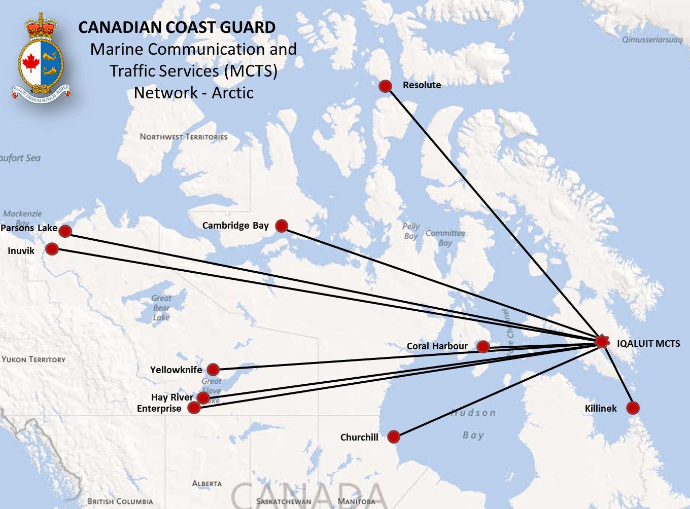
*517 CANADIAN COAST GUARD PUBLICATION - RADIO AIDS TO MARINE NAVIGATION (ATLANTIC, ST. LAWRENCE, GREAT LAKES, LAKE WINNIPEG AND EASTERN ARCTIC) PUBLICATION - 2013 -Facility Information amendment
Part 2 - Page 56 of 62
REPLACE the Diagram
CANADIAN COAST GUARD Marine Communications and Traffic Services (MCTS) Network -Arctic
WITH the Diagram at the following link
CANADIAN COAST GUARD Marine Communications and Traffic Services (MCTS) Network -Arctic
http://www.notmar.gc.ca/eng/services/notmar/sec5jun13eMCTSArcticE.jpg
*518 CANADIAN COAST GUARD PUBLICATION - RADIO AIDS TO MARINE NAVIGATION (ATLANTIC, ST. LAWRENCE, GREAT LAKES, LAKE WINNIPEG AND EASTERN ARCTIC) PUBLICATION - 2013 - Facility Information amendment
Part 2 - Page 57 of 62
RADAR BEACON (RACONS)
ATLANTIC COAST, GULF AND ST.LAWRENCE RIVER TO MONTRÉAL,EASTERN ARCTIC (located in Newfoundland)
Amend
|
NEGRO ISLAND LIGHT 55º21'06"N 60º32'41"W |
6 |
360 |
--.. (Z) |
Open year round |
To Read
|
NEGRO ISLAND LIGHT 56º21'06"N 60º32'41"W |
6 |
360 |
--.. (Z) |
Open year round |
*519 CANADIAN COAST GUARD PUBLICATION - RADIO AIDS TO MARINE NAVIGATION (ATLANTIC, ST. LAWRENCE, GREAT LAKES, LAKE WINNIPEG AND EASTERN ARCTIC) PUBLICATION - 2013 - General Procedures - INSPECTION OF RADIO APPARATUS amendment
Part 4 - Page 64 of 68
AMEND
Project Manager, Ship Radio Inspections
Fisheries and Oceans Canada
Canadian Coast Guard
200 Kent Street, 7th Floor, Station 7S019
Ottawa, ON K1A 0E6
Telephone: 613-998-1520
Facsimile: 613-998-9258
Email: doug.pittman@dfo-mpo.gc.ca
TO READ
Program Manager, Ship Radio Inspections
Fisheries and Oceans Canada
Canadian Coast Guard
200 Kent Street, 7th Floor, Station 7S001
Ottawa, ON K1A 0E6
Telephone: 613-949-7810
Facsimile: 613-998-9258
*520 CANADIAN COAST GUARD PUBLICATION -RADIO AIDS TO MARINE NAVIGATION (ATLANTIC, ST. LAWRENCE, GREAT LAKES, LAKE WINNIPEG AND EASTERN ARCTIC) PUBLICATION - 2013 - General Procedures - Ship Radio Inspection Contacts amendment
Part 4 - Page 66 of 68
AMEND
Canadian Coast Guard
Newfoundland and Labrador
Fisheries and Oceans Canada
Telephone & Fax: 1-888-454-3177
Outside Canada Telephone & Fax: 709-454-3177
To read
Canadian Coast Guard
Newfoundland and Labrador
Fisheries and Oceans Canada
Telephone & Fax: 1-888-454-3177
Outside Canada Telephone & Fax: 709-772-3467
Email: xnfltsc@dfo-mpo.gc.ca
ARC 403 - Western Arctic, First Edition, 2011 -
Chapter 8 - Delete paragraph 265
Replace by: 265 Humboldt Channel is entered south of Cape Edgeworth (69°21′N, 96°07′W), the south tip of Qikiqtarjuaq Island (Tennent Islands). Qikiqtarjuaq Island has numerous and conspicuous light-coloured raised beaches. Tennent Islands (misnamed on Chart 7760 and Chart 7083) are the smaller islands off the NW tip of Qikiqtarjuaq Island.
(C2013-010.01)
Chapter 8 - Paragraph 267, after "SW side of the channel."
Delete: "The largest … beaches."
(C2013-010.02)
Chapter 8 - Delete paragraph 268
Replace by: 268 An excellent anchorage, protected to the north by islets and shoals, is reported to lie between the NW tip of Qikiqtarjuaq Island and the largest island of Tennent Islands, elevation about 80 feet (25 m), 1.5 miles west.
268.1 Sophia Island, a low island 3 miles north of the anchorage area, has Cape Sophia at its north end.
(C2013-010.03)
Chapter 8 - Paragraph 270, after "leads between"
Delete: Tennent Islands
Replace by: Qikiqtarjuaq Island
(C2013-010.04)
INDEX - Delete "Cape Sophia, C8/P268"
Replace by: Cape Sophia, C8/P268.1
(C2013-010.05)
INDEX - After "Qikertajuak Island, C5/P100"
Insert: Qikiqtarjuaq Island, C8/P265
(C2013-010.06)
INDEX - Delete "Sophia, Cape, C8/P268"
Replace by: Sophia, Cape, C8/P268.1
(C2013-010.07)
INDEX - Delete "Sophia Island, C8/P268"
Replace by: Sophia Island, C8/P268.1
(C2013-010.08)
INDEX - Delete "Tennent Islands, C8/P267"
Replace by: Tennent Islands, C8/P265
(C2013-010.09)
ATL 104 - Cape North to Cape Canso (including Bras d'Or Lake), Second Edition, 2010 -
Chapter 1 - Paragraph 42, after "tower on Point Aconi." (Re: Correction promulgated in Monthly Edition No. 11/2012)
Delete: "Starboard hand light … NE of Point Aconi."
(A2013-004.5)
ATL 106 - Gulf of Maine and Bay of Fundy, First Edition, 2001 -
Chapter 4 - Paragraph 82, after "0.3 mile SSW from the cape. A"
Insert: privately maintained
(A2013-006.3)
|
NEWFOUNDLAND |
||||||||||||
|
|
||||||||||||
|
353.4 |
Lewisporte |
|
On East dolphin.
|
Fl |
R |
6s |
3.6 |
..... |
Tower. 2.1 |
Privately maintained by Imperial Oil Lewisporte.
Chart:4862 Edn 05/13
|
||
|
ATLANTIC |
|||||||||||||||||||||||||||||
|
|
|||||||||||||||||||||||||||||
|
157
|
Cape Enragé |
|
Pitch of cape.
|
Fl |
G |
6s |
40.7 |
10 |
White square tower, red upper portion.
|
Flash 1 s; eclipse 5 s.
Year round. Horn - Blast 2 s; sil. 3 s; blast 2 s;
Chart:4337 Edn 05/13(F13-002)
|
|||||||||||||||||||
|
679.5
|
Harbour Shoal |
|
On crib.
|
Fl |
G |
4s |
6.4 |
6 |
White cylindrical tower, green horizontal band, 3 green and white square daymarks facing E., W., and N., black square in center. 3.6 |
Operates at night only.
Chart:4281 Edn 05/13(G13-011)
|
|||||||||||||||||||
|
687.4 |
Chedabucto Bay light buoy C10 |
|
45 30 40.3
|
Fl |
R |
4s |
..... |
..... |
Red, marked "C10". |
Year round.
Chart:4302 Edn 05/13 (G13-009)
|
|||||||||||||||||||
|
687.5 |
Chedabucto Bay light and bell buoy C11 |
|
45 31 48.3
|
Fl |
G |
4s |
..... |
..... |
Green, marked "C11". |
Year round.
Chart:4302 Edn 05/13 (G13-009)
|
|||||||||||||||||||
|
687.7 |
Chedabucto Bay light buoy C13 |
|
45 32 17.8
|
Q |
G |
1s |
..... |
..... |
Green, marked "C13". |
Year round.
Chart:4302 Edn 05/13 (G13-009)
|
|||||||||||||||||||
|
687.8 |
Chedabucto Bay light buoy C14 |
|
45 32 37.3
|
Fl |
R |
4s |
..... |
..... |
Red, marked "C14". |
Year round.
Chart:4302 Edn 05/13 (G13-009)
|
|||||||||||||||||||
|
688 |
Chedabucto Bay light buoy C16
|
|
45 32 31.3
|
Q |
R |
1s |
..... |
..... |
Red, marked "C16". |
Year round.
Chart:4302 Edn 05/13 (G13-009)
|
|||||||||||||||||||
|
688.1 |
Chedabucto Bay light buoy C17 |
|
45 32 39.3
|
Fl |
G |
4s |
..... |
..... |
Green, marked "C17". |
Year round.
Chart:4302 Edn 05/13 (G13-009)
|
|||||||||||||||||||
|
688.2 |
Chedabucto Bay light buoy C18 |
|
45 33 29.3
|
Fl |
R |
4s |
..... |
..... |
Red, marked "C18". |
Year round.
Chart:4302 Edn 05/13 (G13-009)
|
|||||||||||||||||||
|
688.4 |
Chedabucto Bay light buoy C20 |
|
45 33 44.3
|
Q |
R |
1s |
..... |
..... |
Red, marked "C20". |
Year round.
Chart:4302 Edn 05/13 (G13-009)
|
|||||||||||||||||||
|
688.5 |
Chedabucto Bay light buoy C21 |
|
45 34 58.8
|
Fl |
G |
4s |
..... |
..... |
Green, marked "C21". |
Year round. Chart:4302 Edn 05/13 (G13-009)
|
|||||||||||||||||||
|
689.1 |
Eddy Point Cautionary light buoy CY |
|
45 31 27.7
|
Fl |
Y |
4s |
..... |
..... |
Yellow spar, marked "CY". |
Year round.
Chart:4302 Edn 05/13 (G13-009)
|
|||||||||||||||||||
|
689.3
|
|
½½½½½½½½ |
SE. entrance, Strait of Canso.
|
Oc
|
Y
|
11s
|
11.9
|
15
|
Triangular skeleton tower, white daymark, red vertical stripe. 12.3
19.0 |
Flash 10 s; eclipse 1 s.
Chart:4302 Edn 05/13 (G13-009)
|
|||||||||||||||||||
|
689.7
|
|
½½½½½½½½ |
Seacoal Bay Entrance.
|
Oc
|
W
|
11s
|
19.7
|
25
|
Triangular skeleton tower, white daymark, red vertical stripe.
|
Flash 10 s; eclipse 1 s Visible in line of range.
Visible in line of range.
Chart:4302 Edn 05/13 (G13-009)
|
|||||||||||||||||||
|
690
|
Bear Head Direction |
|
SE. end.
|
Fl |
W |
4s |
14.6 |
6 |
Skeleton tower, enclosed lower portion, red and white rectangular daymark.
|
Increased intensity on a bearing of 297°.
Chart:4302 Edn 05/13 (G13-009)
|
|||||||||||||||||||
|
690.3
|
|
½½½½½½½½ |
45 32 21.7
|
F
|
Y
|
.....
|
13.7
|
15
|
Triangular skeleton tower, white daymark, red vertical stripe.
|
Visible in line of range.
Chart:4302 Edn 05/13 (G13-009)
|
|||||||||||||||||||
|
692
|
|
½½½½½½½½ |
On point, W. side of Strait.
|
F
|
Y
|
…..
|
12.3
|
15
|
Triangular skeleton tower, white daymark, red vertical stripe.
|
Visible in line of range.
Chart:4302 Edn 05/13 (G13-009)
|
|||||||||||||||||||
|
694.4
|
range |
½½½½½½½½½ |
S. of rock.
|
F
|
Y
|
.....
|
12.9
|
18 |
Triangular skeleton tower, white daymark, red vertical stripe.
|
Visible in line of range.
Chart:4302 Edn 05/13 (G13-009)
|
|||||||||||||||||||
|
695 |
Point Tupper light buoy C26 |
|
45 36 20.8
|
Fl |
R |
4s |
..... |
..... |
Red, marked "C26". |
Year round.
Chart:4302 Edn 05/13 (G13-009)
|
|||||||||||||||||||
|
696
|
Point Tupper |
|
On small shed on Gypsum loading pier.
|
F |
R |
..... |
29.6 |
..... |
Mast on small shed. |
Privately operated.
Chart:4302 Edn 05/13 (G13-009)
|
|||||||||||||||||||
|
696.5 |
Premier Shoal light buoy CL4 |
|
45 36 47.3
|
Fl |
R |
4s |
..... |
..... |
Red spar, marked "CL4". |
Year round. Chart:4302 Edn 05/13 (G13-009)
|
|||||||||||||||||||
|
697
|
|
½½½½½½½½½½ |
S. side of Canso Causeway.
|
F
|
G
|
.....
|
9.9
|
18
|
Triangular skeleton tower, white trapezoidal daymark, red vertical stripe. 6.1
|
Visible in line of range.
Chart:4302 Edn 05/13 (G13-009)
|
|||||||||||||||||||
|
699 |
Dixon Rock light buoy C28 |
|
45 38 31.3
|
Fl |
R |
4s |
..... |
..... |
Red, marked "C28". |
Year round.
Chart:4302 Edn 05/13 (G13-009)
|
|||||||||||||||||||
|
700
|
Canso Canal SE. mooring dock |
|
45 38 46.6
|
Fl |
Y |
4s |
4.8 |
..... |
Mast. |
Privately operated.
Chart:4302 Edn 05/13 (G13-009)
|
|||||||||||||||||||
|
700.5 |
Canso Causeway |
|
On swing bridge.
|
Fl
|
R
|
4s
|
16.2
|
.....
|
..................................... |
Preparing to open bridge.
Chart:4302 Edn 05/13 (G13-009)
|
|||||||||||||||||||
|
701
|
|
½½½½½½½½½ |
N. end of Canso Lock.
|
Oc
|
Y
|
11s
|
6.0
|
16
|
Square skeleton tower, white trapezoidal daymark, red vertical stripe.
|
Flash 10 s; eclipse 1 s.
Chart:4302 Edn 05/13 (G13-009)
|
|||||||||||||||||||
|
703
|
Canso Canal NE. mooring berth |
|
At outer end of NW. mooring dock.
|
Fl |
Y |
4s |
5.5 |
..... |
Mast. |
Privately operated.
Chart:4302 Edn 05/13 (G13-009)
|
|||||||||||||||||||
|
704
|
|
½½½½½½½½½ |
At Thomas Head.
|
F
|
Y
|
.....
|
12.5
|
15
|
Triangular skeleton tower, white daymark, red vertical stripe.
|
Visible in line of range.
Chart:4302 Edn 05/13 (G13-009)
|
|||||||||||||||||||
|
774
|
Glace Bay North Breakwater |
|
On outer end of N. breakwater.
|
Fl |
R |
3s |
9.0 |
10 |
White cylindrical tower, red horizontal band.
|
Year Round.
Chart:4170 Edn 05/13(G13-012)
|
|||||||||||||||||||
|
883 |
North Canso |
|
W. side of N. entrance to Strait of Canso.
|
Fl |
W |
3s |
36.7 |
10 |
White cylindrical tower, two red horizontal bands.
|
Flash 1 s; eclipse 2 s.
Chart:4302 Edn 05/13(G13-009)
|
|||||||||||||||||||
|
883.2 |
Aulds Cove light buoy VT2 |
|
45 38 59.3
|
Fl |
R |
4s |
….. |
….. |
Red, marked "VT2". |
Seasonal.
Chart:4302 Edn 05/13(G13-009)
|
|||||||||||||||||||
|
1283 |
Pointe à Marcelle range |
½½½½½½½ |
On point.
|
F
|
W
|
…..
….. |
7.9
|
9
9 |
Square skeleton tower, black daymark, red vertical stripe.
|
Visible from line of range.
Chart:4913 Edn 05/13(G13-013, 014)
|
|||||||||||||||||||
|
1671
1671.1
|
|
½½½½½½½½ |
|
|
|
|
|
|
|
Delete from list.
Chart:1220 Edn 05/13(Q13-053, 054)
|
|||||||||||||||||||
|
INLAND WATERS |
|||||||||||
|
|
|||||||||||
|
1608 |
George Island |
|
On E. extremity of island.
|
Fl |
W |
5s |
20.1 |
9 |
Red rectangular skeleton tower. 15.5 |
Visible from all points of marine approach, except in the line of islands and shoals extending NW. from George Island. Seasonal.
Chart:6241 Edn 05/13 (A13-006)
|
|
|
1635.92 |
Wade Point Reef light buoy KE2 |
|
52 14 55.8
|
Fl |
R |
|
..... |
..... |
Red spar, marked "KE2". |
Seasonal.
Chart:6272 Edn 05/13(A13-005)
|
|
CANADIAN COAST GUARD MARINE INFORMATION REPORT AND SUGGESTION SHEET |
Name of Ship or Sender:..................................................................... Date:....................................
Address of Sender:..........................................................................................................................
Street # Street Name
Town / City:.............................. Prov / State:....................... Postal Code / Zip Code: ........................
Tel / Fax / E-mail address of sender (if appropriate):............................................................................
Observation Date:............................................. Time (UTC): ...........................................................
Geographical Position:......................................................................................................................
Coordinate Position: Lat: ............................................... Long:.........................................................
Position Method: q DGPS q GPS with WAAS q GPS q Radar qOther
Horizontal Datum Used: qWGS 84 q NAD 27 q Other
Estimated Position Accuracy:............................................................................................................
Chart #:............................................................ Datum: q NAD 27 q NAD 83
Chart Edition:.................................................... Last Correction applied:............................................
Publications affected: (Quote Volume and page):.................................................................................
*Full details (Attach additional sheets as necessary)............................................................................
Mariners are requested to notify the responsible authorities when new or suspected dangers to navigation are discovered, changes are observed in aids to navigation, or corrections to publications are seen to be necessary.
In the case of new or suspected dangers to navigation, it is important that all details be given in order to aid with future investigations. Items of interest include heights, depths, physical description, type of bottom and equipment method used to position the item. It is helpful to mark details on chart, which will be promptly replaced by the Canadian Hydrographic Service.
Reports should be made to the nearest Marine Communications and Traffic Services Centre (MCTS) and should be confirmed in writing to:
|
Director, Navigation Systems Canadian Coast Guard Department of Fisheries and Oceans Ottawa, Ontario, K1A 0E6
|
In the case of information concerning aids to navigation or the List of Lights, Buoys and Fog Signals. |
|
OR |
|
Dominion Hydrographer Canadian Hydrographic Service Department of Fisheries and Oceans Ottawa, Ontario, K1A 0E6
|
In the case of new or suspected dangers to navigation or where corrections to "Sailing Directions" appear to be necessary. |
Or general questions on Coast Guard programs or services please send an e-mail message to:
info@dfo-mpo.gc.ca
(Please include your postal code and e-mail address)