
Archived information
The Standard on Web Usability replaces this content. This content is archived because Common Look and Feel 2.0 Standards have been rescinded.
Archived information is provided for reference, research or recordkeeping purposes. It is not subject to the Government of Canada Web Standards and has not been altered or updated since it was archived.
NOTICES TO MARINERS
PUBLICATION
WESTERN EDITION

Safety First, Service Always
Published Monthly by the
CANADIAN COAST GUARD
www.notmar.gc.ca/subscribe/
CONTENTS
| Section 1 | General and Safety Information |
| Section 2 | Chart Corrections |
| Section 3 | Radio Aids to Marine Navigation Corrections |
| Section 4 | Sailing Directions and Small Craft Guide Corrections |
| Section 5 | List of Lights, Buoys and Fog Signals Corrections |
Canadian Coast Guard Programs
Aids to Navigation and Waterways
Fisheries and Oceans Canada
Montreal, Quebec
H2Y 2E7
© Her Majesty the Queen in Right of Canada, 2017
DFO/2017-2003
Fs152-6E-PDF
ISSN 1719-7708
Disponible en français :
Publication des Avis aux navigateurs
Édition de l'Ouest
Édition mensuelle Nº12/2017
Fisheries and Oceans Canada
Official Publication of the Canadian Coast Guard
DFO/2018-2003
EXPLANATORY NOTES
Geographical positions refer directly to the graduations of the largest scale Canadian Hydrographic chart unless otherwise indicated.
Bearings refer to the true compass and are measured clockwise from 000° (North) clockwise to 359°; those relating to lights are from seaward.
Visibility of lights is that in clear weather.
Depths - The units used for soundings (metres, fathoms or feet) are stated in the title of each chart.
Elevations are normally given above Higher High Water, Large Tide unless otherwise indicated.
Distances may be calculated as follows:
1 nautical mile = 1,852 metres (6,076.1 feet)
1 statute mile = 1,609.3 metres (5,280 feet)
1 metre = 3.28 feet
Temporary & Preliminary Notices are indicated by a (T) or a (P) in Section 1, respectively. Please note that Nautical charts are not amended by the Canadian Hydrographic Service for Temporary (T) and Preliminary (P) Notices. It is recommended that mariners chart these corrections in pencil. The list of charts affected by Temporary and Preliminary Notices are revised and promulgated quarterly in Section 1 of the Monthly Edition.
Please note that, in addition to the temporary and preliminary changes normally advertised as (T) and (P) Notices, there are a few permanent changes to aids to navigation that have been advertised as Preliminary Notices to Mariners while charts are being updated for new editions.
Marine Information Report & Suggestion Sheet
Mariners are requested to notify the responsible authorities when new or suspected dangers to navigation are discovered, changes observed in aids to navigation or corrections to publications are seen
to be necessary. Such communications can be made using the Marine Information Report & Suggestion Sheet inserted on the last
page of each monthly edition of Notices to Mariners.
Canadian Hydrographic Service - Information Published in Section 2 of Notices to Mariners
Mariners are advised that only the most critical changes that directly affect safety to navigation are issued in Section 2 – Chart Corrections. This limitation
is required to ensure that charts remain as clear and easy to read as possible. As a result, mariners may see minor discrepancies of a
non-critical nature between information in official publications. For example, a small change in the nominal range or focal height of a light
may not result in the production of a chart correction in Notices to Mariners, but may result in a correction in the List of Lights, Buoys and
Fog Signals publication.
In case of discrepancy between information provided on CHS charts relating to aids to navigation, and the List of Lights, Buoys and Fog Signals publication, the latter shall be deemed as containing the most up-to-date information.
Canadian Nautical Charts & Publications
A source list of Canadian nautical charts and publications is published in Notice No. 14 of the Notices to Mariners Annual Edition 2018. The source supply and the prices
effective at the time of printing are listed. For current chart edition dates, please refer to the following website:
www.chs-shc.gc.ca/charts-cartes/paper-papier/index-eng.asp
CHART CORRECTIONS - SECTION 2
Corrections to nautical charts will be listed in numerical order by chart number. Each chart correction listed applies only to that particular chart. Related charts, if any, will have their own specific correction listed separately.
Users should also refer to CHS Chart 1: Symbols, Abbreviations and Terms for additional information pertaining to the correction of charts.
The illustration below describes the elements that will comprise a typical Section 2 chart correction:

The last correction number is identified with the LNM/D or Last Notice to Mariners Number / Date.
NOTICES TO MARINERS WEBSITE – MONTHLY EDITIONS, CHART CORRECTIONS, AND CHART PATCHES
The Notices to Mariners website allows users to access the monthly publications,
chart corrections, and chart patches.
Users can subscribe for free to the email notification service
to receive notifications when charts of interest are updated, including their patches, as well as when a new monthly edition becomes available online.
ADVISORY NOTICES TO SHIPPING (BROADCAST AND WRITTEN)
The Canadian Coast Guard is implementing a number of changes to the aids to navigation system in Canada.
These changes are advertised as Notices to Shipping (Broadcast and Written) by the Canadian Coast Guard, and are then followed up with Notices to Mariners, then charts are updated by hand correction, reprints or new editions.
Mariners are advised that all relevant Written Notices to Shipping should be kept until superseded by Notices to Mariners or through revised charts issued by the Canadian Hydrographic Service (CHS).
Written Notices to Shipping are available on the Canadian Coast Guard website at: www.ccg-gcc.gc.ca/eng/CCG/NOTSHIP.
The Canadian Hydrographic Service is reviewing the impact of these changes with the Canadian Coast Guard and together are preparing an action plan on the issuing of chart revisions.
For further information, contact your local Regional Notices to Shipping (NOTSHIP) issuing authorities.
Western
MCTS Western Regional Office
Canadian Coast Guard
Institute of Ocean Sciences
P.O. Box 6000
9860 West Saanich Rd.
Sidney, BC V8L 4B2
Telephone: (250) 363-8904 (Regional Administrative Assistant)
Email: NOTSHIP.Western@innav.gc.ca
* Iqaluit MCTS Centre
Operational from approximately mid-May until late December.
Canadian Coast Guard
P.O. Box 189
Iqaluit, NU X0A 0H0
“A” Series NOTSHIPs
Telephone: (867) 979-5269
Facsimile: (867) 979-4264
Email: IqaNordreg@innav.gc.ca
Website:
http://www.ccg-gcc.gc.ca/eng/CCG/Notship-Home
“H” Series NOTSHIPs
Telephone: (867) 979-0310
Facsimile: (867) 979-4264
Email: Iqamck01@innav.gc.ca
Website:
http://www.ccg-gcc.gc.ca/eng/CCG/Notship-Home
* Service available in English and French.
Index
NUMERICAL INDEX OF CANADIAN CHARTS AFFECTED
| 3000 | 3737 | 3977 | 6206 |
| 3002 | 3742 | 3978 | 6207 |
| 3481 | 3744 | 3982 | 6241 |
| 3490 | 3800 | 3983 | 6249 |
| 3493 | 3808 | 3986 | 6258 |
| 3536 | 3902 | 3987 | |
| 3724 | 3945 | 6022 |
SECTION 1 - GENERAL AND SAFETY INFORMATION
CANADIAN HYDROGRAPHIC SERVICE – ANNOUNCEMENT REGARDING CHS CHART PATCHES
Colour Web Patches are free to the mariner, and given the quality of many printers, should reproduce well. They will be available in real time all around the world.
CHS welcomes your feedback on this service at chsinfo@dfo-mpo.gc.ca
CANADIAN HYDROGRAPHIC SERVICE – CUMULATIVE CHART CORRECTIONS
The cumulative chart corrections published in Notices to Mariners can now be accessed at
CANADIAN HYDROGRAPHIC SERVICE – CURRENT CHART EDITION DATES
CHART EDITIONS
The three terms described below are used to indicate the publication status of Canadian charts.
NEW CHART - "NEWCHT"
The first publication of a Canadian chart embracing an area not previously charted to the scale shown, or embracing an area different from any existing Canadian chart.
NEW EDITION - "NEWEDT"
A new issue of an existing chart containing amendments essential to navigation in addition to those issued in Notices to Mariners and making existing editions obsolete.
REPRINTS
A new issue of the current edition of a chart incorporating no amendments of navigational significance other than those previously promulgated in Notices to Mariners. It may also contain amendments from other sources provided they are not essential to navigation. Previous printings of the current edition remain in force.
The current chart edition dates can be accessed at www.chs-shc.gc.ca/charts-cartes/paper-papier/index-eng.asp
CANADIAN HYDROGRAPHIC SERVICE – PRINT ON DEMAND CHARTS - CARE AND USE
Background
By providing nautical charts to the public, the goal of the Canadian Hydrographic Service (CHS) is to provide services for safe navigation in a fiscally responsible manner. As a result, CHS continues to expand its portfolio of nautical paper charts that are printed using Print On Demand (POD) technology. These charts are easily recognized by their whiter paper and the coloured logo of the Canadian Hydrographic Service. This new technology enables CHS to print charts in a more efficient manner, while enhancing chart content through being able to quickly add new and important information. POD technology provides customers with up-to-date charts without the historical hand-drawn corrections or glued-on patches. Additionally, this technology eliminates out-of-stock situations which arise with the traditional printing and warehousing methods. In the event of a national emergency, CHS can respond to the appropriate authorities with the best available information very quickly.
Care of Your POD Chart
CHS encourages its customers to handle the POD charts more carefully than the traditional lithographic charts. When plotting information on POD charts, use HB pencils and apply limited pressure. Testing has suggested that an Indian gum eraser is more effective than alternatives when used on the product. This eraser is also suitable for charts printed using lithographic processes.
CANADIAN HYDROGRAPHIC SERVICE, TRANSPORT CANADA – NAVIGATION SAFETY - ECDIS
Mariners are advised that ECDIS may not display some isolated shoal depths when operating in "base or standard display" mode. Route planning and monitoring alarms for these shoal depths may not always be activated. To ensure safe navigation and to confirm that a planned route is clear of such dangers, mariners should visually inspect the planned route and any deviations from it using ECDIS configured to display "all data". The automated voyage planning check function should not be solely relied upon.
CANADIAN HYDROGRAPHIC SERVICE – MODIFICATION TO CATALOGUE 2: PACIFIC COAST/CÔTE PACIFIQUE
The Canadian Hydrographic Service has been recently informed that there is an error in the following chart catalogue:
Catalogue 2: Pacific Coast/Côte pacifique
Affix patch to Catalogue 2: Pacific Coast/Côte pacifique provided in Section 1 of this monthly edition.
https://www.notmar.gc.ca/publications/monthly-mensuel/images/ed072017-part1-catalogue2-patch.pdf
CANADIAN HYDROGRAPHIC SERVICE – CORRECTION TO CHART NO. 1 PUBLICATION DATE
The Canadian Hydrographic Service would like to inform you that there is an error in the edition date of some versions of Chart No. 1, 2016. The correct edition date is March 2016. For all other updates to Chart No. 1, please refer to the following web pages:
English - http://www.charts.gc.ca/publications/chart1-carte1/updates-eng.asp
French - http://www.charts.gc.ca/publications/chart1-carte1/updates-fra.asp
*1201 CANADIAN HYDROGRAPHIC SERVICE – ELECTRONIC NAVIGATIONAL CHARTS
|
S-57 ENC NUMBER |
CHART TITLE |
|---|---|
|
NEW PRODUCTS |
|
|
CA276322 |
Cape Harrison to/à Nunaksaluk Island |
|
CA470613 |
Caamaño to/à Nepean Sound |
|
CA576086 |
St. George's Public Wharf / Quai public |
|
CA576087 |
Flintkote Wharf / Quai |
|
CA576191 |
Little Port |
|
CA576192 |
The Narrows |
|
CA576419 |
St. Anthony Bight and Harbour |
|
CA576420 |
St. Anthony Harbour |
|
CA576550 |
Dingwall Harbour |
|
CA576661 |
Port Hood |
|
CA576663 |
Mabou Harbour |
|
CA576742 |
Ingonish Harbour and Approaches/et les Approches |
*1202 CANADIAN HYDROGRAPHIC SERVICE – RASTER DIGITAL CHARTS (BSB V3)
|
CHARTS |
MAIN TITLE |
SCALE |
PUBLISHED |
|---|---|---|---|
|
New Editions |
|||
|
RM-7920 |
Tanquary, Slidre and Glacier Fiords |
1:100 000 |
15-MAY-2015 |
*1203 TRANSPORT CANADA – SHIP SAFETY BULLETIN #09/2017
This is to notify you that a new Ship Safety Bulletin has recently been posted to the Transport Canada website at www.tc.gc.ca/ssb-bsn/.
To go online to view or download this bulletin, please click on the link below:
SSB#09/2017– Update on How to Meet STCW 2010 Manila Convention Requirements
RDIMS#12194325
Sign yourself up for e-Bulletin to receive an e-mail notice each time a new Ship Safety Bulletin is published on our Website.
Contact us at: marinesafety-securitemaritime@tc.gc.ca or 1-855-859-3123 (Toll Free).
*1206(T) LAKE ROSSEAU AND/ET LAKE JOSEPH – UNLIT BUOY TEMPORARY ESTABLISHED
Reference Chart: 6022
The following unlit buoy has been temporary established:
P3/1 (LL 9089.1) (45º 08’ 09.0’’N 079º 40’ 36.0’’W)
(D2017-006)
SECTION 2 - CHART CORRECTIONS
3000 - Juan de Fuca Strait to/à Dixon Entrance - New Edition - 20-JAN-1989 - NAD 1927
| 22-DEC-2017 | LNM/D. 21-APR-2017 | ||
| Add |
light with RACON (See Chart No. 1, P1, S3.1) This notice affects Electronic Navigational Chart: CA270724, CA470730 |
52°51′36.9″N 129°20′50.7″W | |
| (P2017076) LL(628.5) DFO(6203595-01) |
3002 - Queen Charlotte Sound to/à Dixon Entrance - New Edition - 16-DEC-1994 - NAD 1927
| 22-DEC-2017 | LNM/D. 24-NOV-2017 | ||
| Amend |
Fl to read Fl R against light (See Chart No. 1, P1) This notice affects Electronic Navigational Chart: CA270390, CA370441, CA470658 |
53°42′27.3″N 130°24′43.0″W | |
| (P2017075) LL(743) DFO(6203590-01) | |||
| Delete |
radar reflector (See Chart No. 1, S4) This notice affects Electronic Navigational Chart: CA270390, CA370441, CA470658 |
53°42′27.3″N 130°24′43.0″W | |
| DFO(6203590-02) | |||
| Add |
light Fl(3) with RACON (See Chart No. 1, P1, S3.1) This notice affects Electronic Navigational Chart: CA270724, CA470730 |
52°51′36.9″N 129°20′50.7″W | |
| (P2017076) LL(628.5) DFO(6203595-01) |
3481 - Approaches to/Approches à Vancouver Harbour - New Edition - 06-APR-2012 - NAD 1983
| 08-DEC-2017 | LNM/D. 14-JUL-2017 | ||
| Add |
depth of 12.5 metres (See Chart No. 1, I10) This notice affects Electronic Navigational Chart: CA470072, CA570073 |
49°17′24.6″N 123°06′38.8″W | |
| DFO(6203587-02) | |||
| Add |
depth of 14.7 metres (See Chart No. 1, I10) This notice affects Electronic Navigational Chart: CA470072, CA570073 |
49°17′20.7″N 123°05′32.7″W | |
| DFO(6203588-01) | |||
| Delete |
depth of 15.4 metres (See Chart No. 1, I10) This notice affects Electronic Navigational Chart: CA470072 |
49°17′20.5″N 123°05′34.8″W | |
| DFO(6203588-04) |
3490 - Fraser River/Fleuve Fraser, Sand Heads to/à Douglas Island, Compartment A-B - New Edition - 02-NOV-2012 - World Geodetic System 1984
| 08-DEC-2017 | LNM/D. 20-OCT-2017 | ||
| Amend |
Q Y 11m to read Iso Y 2s11m against light (See Chart No. 1, P20.2) This notice affects Electronic Navigational Chart: CA570015 |
49°08′54.7″N 123°02′24.0″W | |
| (P2017072) LL(353) DFO(6203584-01) | |||
| Amend |
Iso Y 2s 19m to read Oc Y 3s19m against light (See Chart No. 1, P20.2) This notice affects Electronic Navigational Chart: CA570015 |
49°09′01.3″N 123°02′15.1″W | |
| (P2017073) LL(354) DFO(6203585-01) |
3490 - Fraser River/Fleuve Fraser, Sand Heads to/à Douglas Island, Compartment B-C - New Edition - 02-NOV-2012 - World Geodetic System 1984
| 08-DEC-2017 | LNM/D. 20-OCT-2017 | ||
| Amend |
Q Y 11m to read Iso Y 2s11m against light (See Chart No. 1, P20.2) This notice affects Electronic Navigational Chart: CA570015 |
49°08′54.7″N 123°02′24.0″W | |
| (P2017072) LL(353) DFO(6203584-01) | |||
| Amend |
Iso Y 2s 19m to read Oc Y 3s19m against light (See Chart No. 1, P20.2) This notice affects Electronic Navigational Chart: CA570015 |
49°09′01.3″N 123°02′15.1″W | |
| (P2017073) LL(354) DFO(6203585-01) |
3493 - Vancouver Harbour Western Portion/Partie Ouest - New Edition - 11-JUN-2010 - NAD 1983
| 08-DEC-2017 | LNM/D. 14-JUL-2017 | ||
| Delete |
depth of 14.1 metres (See Chart No. 1, I10) This notice affects Electronic Navigational Chart: CA570073 |
49°17′24.6″N 123°06′38.0″W | |
| DFO(6203587-01) | |||
| Add |
depth of 12.5 metres (See Chart No. 1, I10) This notice affects Electronic Navigational Chart: CA470072, CA570073 |
49°17′24.6″N 123°06′38.8″W | |
| DFO(6203587-02) | |||
| Add |
depth of 14.7 metres (See Chart No. 1, I10) This notice affects Electronic Navigational Chart: CA470072, CA570073 |
49°17′20.7″N 123°05′32.7″W | |
| DFO(6203588-01) | |||
| Add |
depth of 15.0 metres (See Chart No. 1, I10) This notice affects Electronic Navigational Chart: CA570073 |
49°17′21.2″N 123°05′37.7″W | |
| DFO(6203588-02) | |||
| Add |
depth of 14.9 metres (See Chart No. 1, I10) This notice affects Electronic Navigational Chart: CA570073 |
49°17′22.7″N 123°05′34.7″W | |
| DFO(6203588-03) |
3536 - Sturt Bay and/et Vananda Cove - New Chart - 21-APR-1978 - NAD 1927
| 01-DEC-2017 | LNM/D. 28-APR-2017 | ||
| Delete |
pontoon (See Chart No. 1, F16) This notice affects Electronic Navigational Chart: CA570158 |
joining 49°45′37.9″N 124°33′45.1″W 49°45′36.8″N 124°33′45.3″W 49°45′37.4″N 124°33′41.1″W and 49°45′37.4″N 124°33′38.1″W |
|
| DFO(6203583-01) | |||
| Delete |
depth of 0.6 metres (See Chart No. 1, I10) This notice affects Electronic Navigational Chart: CA570158 |
49°45′37.1″N 124°33′40.4″W | |
| DFO(6203583-02) | |||
| Delete |
depth of 13.4 metres (See Chart No. 1, I10) This notice affects Electronic Navigational Chart: CA570158 |
49°45′38.0″N 124°33′45.5″W | |
| DFO(6203583-03) | |||
| Delete |
pontoon (See Chart No. 1, F16) This notice affects Electronic Navigational Chart: CA570158 |
between 49°45′38.9″N 124°33′42.1″W and 49°45′38.5″N 124°33′43.8″W |
|
| DFO(6203583-04) | |||
| Add |
pontoon (See Chart No. 1, F16) This notice affects Electronic Navigational Chart: CA570158 |
between 49°45′37.1″N 124°33′37.9″W and 49°45′37.1″N 124°33′46.9″W |
|
| DFO(6203583-05) | |||
| Add |
pontoon (See Chart No. 1, F16) This notice affects Electronic Navigational Chart: CA570158 |
between 49°45′36.3″N 124°33′46.9″W and 49°45′38.1″N 124°33′46.9″W |
|
| DFO(6203583-06) | |||
| Add |
pontoon (See Chart No. 1, F16) This notice affects Electronic Navigational Chart: CA570158 |
between 49°45′37.1″N 124°33′45.9″W and 49°45′38.8″N 124°33′45.9″W |
|
| DFO(6203583-07) | |||
| Add |
pontoon (See Chart No. 1, F16) This notice affects Electronic Navigational Chart: CA570158 |
between 49°45′37.1″N 124°33′44.9″W and 49°45′38.8″N 124°33′44.9″W |
|
| DFO(6203583-08) | |||
| Add |
pontoon (See Chart No. 1, F16) This notice affects Electronic Navigational Chart: CA570158 |
between 49°45′37.1″N 124°33′43.9″W and 49°45′38.8″N 124°33′43.9″W |
|
| DFO(6203583-09) | |||
| Add |
wreck, least depth unknown, dangerous to surface
navigation (See Chart No. 1, K28) This notice affects Electronic Navigational Chart: CA570158 |
49°45′36.5″N 124°33′50.3″W | |
| DFO(6203583-10) | |||
| Add |
wreck with known depth of 9.9 metres (See Chart No. 1, K28) This notice affects Electronic Navigational Chart: CA570158 |
49°45′48.7″N 124°33′34.3″W | |
| DFO(6203583-11) | |||
| Delete |
depth of 8.2 metres (See Chart No. 1, I10) This notice affects Electronic Navigational Chart: CA570158 |
49°45′37.8″N 124°33′43.5″W | |
| DFO(6203583-12) | |||
| Delete |
depth of 18 metres (See Chart No. 1, I10) This notice affects Electronic Navigational Chart: CA570158 |
49°45′49.0″N 124°33′34.1″W | |
| DFO(6203583-13) |
3724 - Caamaño Sound and Approaches/et les approches - New Edition - 23-MAY-1980 - Unknown
| 22-DEC-2017 | LNM/D. 24-MAR-2017 | ||
| Add |
light Fl(3) 12s42ft7M with RACON (See Chart No. 1, P1, S3.1) This notice affects Electronic Navigational Chart: CA270724, CA470730 |
52°51′39.1″N 129°20′42.4″W | |
| (P2017076) LL(628.5) DFO(6203595-01) | |||
| 29-DEC-2017 | LNM/D. 22-DEC-2017 | ||
| Amend |
Qk Fl to read Q G against light (See Chart No. 1, P1) This notice affects Electronic Navigational Chart: CA470611 |
53°05′29.7″N 129°10′21.4″W | |
| (P2017078) LL(634) DFO(6203593-01) | |||
| Add |
light Fl G (See Chart No. 1, P1) This notice affects Electronic Navigational Chart: CA470611 |
53°02′50.6″N 129°18′48.2″W | |
| (P2017079) LL(631.6) DFO(6203594-01) |
3737 - Laredo Channel including/y compris Laredo Inlet and/et Surf Inlet - New Edition - 14-AUG-1987 - Unknown
| 29-DEC-2017 | LNM/D. 24-MAR-2017 | ||
| Amend |
Q to read Q G against light (See Chart No. 1, P1) This notice affects Electronic Navigational Chart: CA470611 |
53°05′29.3″N 129°10′25.5″W | |
| (P2017078) LL(634) DFO(6203593-01) | |||
| Add |
light Fl G (See Chart No. 1, P1) This notice affects Electronic Navigational Chart: CA470611 |
53°02′50.2″N 129°18′52.3″W | |
| (P2017079) LL(631.6) DFO(6203594-01) |
3742 - Otter Passage to/à McKay Reach - New Edition - 16-JUL-1982 - NAD 1927
| 08-DEC-2017 | LNM/D. 07-JUL-2017 | ||
| Add |
light Q G (See Chart No. 1, P1) This notice affects Electronic Navigational Chart: CA370721, CA470590, CA570592 |
53°24′06.9″N 129°16′47.6″W | |
| (P2017071) LL(651.4) DFO(6203582-01) | |||
| 29-DEC-2017 | LNM/D. 08-DEC-2017 | ||
| Amend |
Q to read Q G against light (See Chart No. 1, P1) This notice affects Electronic Navigational Chart: CA470611 |
53°05′28.3″N 129°10′23.6″W | |
| (P2017078) LL(634) DFO(6203593-01) |
3744 - Queen Charlotte Sound - New Edition - 20-MAY-1988 - NAD 1927
| 22-DEC-2017 | LNM/D. 24-NOV-2017 | ||
| Amend |
Fl to read Fl R against light (See Chart No. 1, P1) This notice affects Electronic Navigational Chart: CA270390, CA370441, CA470658 |
53°42′28.0″N 130°24′37.0″W | |
| (P2017075) LL(743) DFO(6203590-01) | |||
| Delete |
radar reflector (See Chart No. 1, S4) This notice affects Electronic Navigational Chart: CA270390, CA370441, CA470658 |
53°42′28.0″N 130°24′37.0″W | |
| DFO(6203590-02) | |||
| Add |
light Fl(3) with RACON (See Chart No. 1, P1, S3.1) This notice affects Electronic Navigational Chart: CA270724, CA470730 |
52°51′37.6″N 129°20′44.7″W | |
| (P2017076) LL(628.5) DFO(6203595-01) |
3800 - Dixon Entrance - New Chart - 06-MAY-2011 - NAD 1983
| 22-DEC-2017 | LNM/D. 17-NOV-2017 | ||
| Amend |
Fl to read Fl R against light (See Chart No. 1, P1) This notice affects Electronic Navigational Chart: CA270390, CA370441, CA470658 |
53°42′27.3″N 130°24′43.0″W | |
| (P2017075) LL(743) DFO(6203590-01) |
3808 - Juan Perez Sound - New Edition - 30-DEC-2005 - NAD 1983
| 22-DEC-2017 | LNM/D. 18-AUG-2017 | ||
| Delete |
depth of 3 metres (See Chart No. 1, I10) This notice affects Electronic Navigational Chart: CA470330 |
52°32′51.0″N 131°21′04.0″W | |
| DFO(6203589-01) | |||
| Add |
depth of 2.2 metres (See Chart No. 1, I10) This notice affects Electronic Navigational Chart: CA470330 |
52°32′51.2″N 131°21′06.9″W | |
| DFO(6203589-02) | |||
| Add |
depth of 4.9 metres (See Chart No. 1, I10) This notice affects Electronic Navigational Chart: CA470330 |
52°32′53.8″N 131°20′58.8″W | |
| DFO(6203589-03) | |||
| Delete |
depth of 11 metres (See Chart No. 1, I10) This notice affects Electronic Navigational Chart: CA470330 |
52°34′30.5″N 131°20′52.4″W | |
| DFO(6203589-04) | |||
| Add |
depth of 3.6 metres (See Chart No. 1, I10) This notice affects Electronic Navigational Chart: CA470330 |
52°34′29.6″N 131°20′53.5″W | |
| DFO(6203589-05) | |||
| Add |
depth of 6.5 metres (See Chart No. 1, I10) This notice affects Electronic Navigational Chart: CA470330 |
52°34′30.0″N 131°20′59.6″W | |
| DFO(6203589-06) | |||
| Delete |
depth of 21.9 metres (See Chart No. 1, I10) This notice affects Electronic Navigational Chart: CA470330 |
52°35′08.3″N 131°21′43.7″W | |
| DFO(6203589-07) | |||
| Add |
depth of 9.7 metres (See Chart No. 1, I10) This notice affects Electronic Navigational Chart: CA470330 |
52°35′09.7″N 131°21′46.8″W | |
| DFO(6203589-08) | |||
| Delete |
depth of 13.4 metres (See Chart No. 1, I10) This notice affects Electronic Navigational Chart: CA470330 |
52°35′11.0″N 131°22′10.0″W | |
| DFO(6203589-09) | |||
| Add |
depth of 4.3 metres (See Chart No. 1, I10) This notice affects Electronic Navigational Chart: CA470330 |
52°35′09.5″N 131°22′10.6″W | |
| DFO(6203589-10) | |||
| Delete |
depth of 14 metres (See Chart No. 1, I10) This notice affects Electronic Navigational Chart: CA470330 |
52°32′55.5″N 131°20′57.1″W | |
| DFO(6203589-11) |
3902 - Hecate Strait - New Edition - 09-DEC-1988 - NAD 1927
| 22-DEC-2017 | LNM/D. 23-JUN-2017 | ||
| Amend |
Fl to read Fl R against light (See Chart No. 1, P1) This notice affects Electronic Navigational Chart: CA270390, CA370441, CA470658 |
53°42′28.1″N 130°24′37.0″W | |
| (P2017075) LL(743) DFO(6203590-01) | |||
| Delete |
radar reflector (See Chart No. 1, S4) This notice affects Electronic Navigational Chart: CA270390, CA370441, CA470658 |
53°42′28.1″N 130°24′37.0″W | |
| DFO(6203590-02) | |||
| Add |
light Fl(3) with RACON (See Chart No. 1, P1, S3.1) This notice affects Electronic Navigational Chart: CA270724, CA470730 |
52°51′37.7″N 129°20′44.7″W | |
| (P2017076) LL(628.5) DFO(6203595-01) |
3945 - Approaches to/Approches à Douglas Channel - New Chart - 25-DEC-2009 - NAD 1983
| 08-DEC-2017 | LNM/D. 26-MAY-2017 | ||
| Add |
light Q G (See Chart No. 1, P1) This notice affects Electronic Navigational Chart: CA370721, CA470590, CA570592 |
53°24′06.1″N 129°16′53.7″W | |
| (P2017071) LL(651.4) DFO(6203582-01) |
3945 - Coghlan Anchorage - New Chart - 25-DEC-2009 - NAD 1983
| 08-DEC-2017 | LNM/D. 26-MAY-2017 | ||
| Add |
light Q G (See Chart No. 1, P1) This notice affects Electronic Navigational Chart: CA370721, CA470590, CA570592 |
53°24′06.1″N 129°16′53.7″W | |
| (P2017071) LL(651.4) DFO(6203582-01) |
3977 - Douglas Channel - New Chart - 27-DEC-2013 - World Geodetic System 1984
| 08-DEC-2017 | LNM/D. 07-JUL-2017 | ||
| Add |
light Q G (See Chart No. 1, P1) This notice affects Electronic Navigational Chart: CA370721, CA470590, CA570592 |
53°24′06.1″N 129°16′53.7″W | |
| (P2017071) LL(651.4) DFO(6203582-01) |
3978 - Bonilla Island to/à Edye Passage - New Chart - 01-JUL-2016 - World Geodetic System 1984
| 22-DEC-2017 | LNM/D. 04-AUG-2017 | ||
| Amend |
Fl 10m5M to read Fl R 11m5M against light (See Chart No. 1, P1) This notice affects Electronic Navigational Chart: CA270390, CA370441, CA470658 |
53°42′27.3″N 130°24′43.0″W | |
| (P2017075) LL(743) DFO(6203590-01) |
3982 - Caamaño Sound to/à Whale Channel - New Chart - 30-OCT-2015 - World Geodetic System 1984
| 22-DEC-2017 | LNM/D. 17-MAR-2017 | ||
| Add |
light Fl(3) 12s13m7M with RACON (See Chart No. 1, P1, S3.1) This notice affects Electronic Navigational Chart: CA270724, CA470730 |
52°51′36.9″N 129°20′50.7″W | |
| (P2017076) LL(628.5) DFO(6203595-01) | |||
| 29-DEC-2017 | LNM/D. 22-DEC-2017 | ||
| Amend |
Q to read Q G 8m4M against light (See Chart No. 1, P1) This notice affects Electronic Navigational Chart: CA470611 |
53°05′27.5″N 129°10′29.7″W | |
| (P2017078) LL(634) DFO(6203593-01) | |||
| Add |
light Fl G 7m5M (See Chart No. 1, P1) This notice affects Electronic Navigational Chart: CA470611 |
53°02′48.4″N 129°18′56.5″W | |
| (P2017079) LL(631.6) DFO(6203594-01) |
3983 - Caamaño Sound to/à Principe Channel - New Chart - 26-MAY-2017 - World Geodetic System 1984
| 22-DEC-2017 | |||
| Add |
rock which covers and uncovers (See Chart No. 1, K11) This notice affects Electronic Navigational Chart: CA470613 |
53°04′05.2″N 129°44′23.7″W | |
| DFO(6203591-01) | |||
| Add |
rock which covers and uncovers (See Chart No. 1, K11) This notice affects Electronic Navigational Chart: CA470613 |
53°01′24.3″N 129°38′42.2″W | |
| DFO(6203591-02) |
3986 - Browning Entrance - New Chart - 25-DEC-2009 - NAD 1983
| 22-DEC-2017 | LNM/D. 04-AUG-2017 | ||
| Amend |
Fl 10m5M to read Fl R 11m5M against light (See Chart No. 1, P1) This notice affects Electronic Navigational Chart: CA270390, CA370441, CA470658 |
53°42′27.3″N 130°24′43.0″W | |
| (P2017075) LL(743) DFO(6203590-01) | |||
| 29-DEC-2017 | LNM/D. 22-DEC-2017 | ||
| Amend |
Fl 6s6m5M to read Fl 6s7m4M against light (See Chart No. 1, P1) This notice affects Electronic Navigational Chart: CA270390, CA370441, CA470624 |
53°47′23.2″N 130°31′20.2″W | |
| (P2017082) LL(746) DFO(6203598-01) |
3987 - Kitkatla Channel and/et Porcher Inlet - New Chart - 25-DEC-2009 - NAD 1983
| 29-DEC-2017 | LNM/D. 13-JAN-2017 | ||
| Amend |
Fl 6s6m5M to read Fl 6s7m4M against light (See Chart No. 1, P1) This notice affects Electronic Navigational Chart: CA270390, CA370441, CA470624 |
53°47′23.2″N 130°31′20.2″W | |
| (P2017082) LL(746) DFO(6203598-01) |
6206 - Seven Sisters Falls to/à Slave Falls - Sheet/Feuille 1 - New Edition - 15-SEP-2000 - NAD 1983
| 08-DEC-2017 | LNM/D. 28-AUG-2015 | ||
| Amend |
vertical clearance of 42 feet, to read 34 feet (See Chart No. 1, D22) |
50°13′12.5″N 095°34′06.2″W | |
| DFO(6604375-01) | |||
| Amend |
vertical clearance of 42 feet, to read 34 feet (See Chart No. 1, D22) |
50°13′15.6″N 095°33′56.8″W | |
| DFO(6604375-02) | |||
| Amend |
vertical clearance of 40 feet, to read 35 feet (See Chart No. 1, D22) |
50°13′14.7″N 095°33′47.5″W | |
| DFO(6604375-03) |
6207 - Continuation A - Sheet/Feuille 1 - New Edition - 24-MAR-2000 - NAD 1983
| 08-DEC-2017 | LNM/D. 22-AUG-2014 | ||
| Amend |
vertical clearance of 42 feet, to read 34 feet (See Chart No. 1, D22) |
50°13′12.4″N 095°34′07.4″W | |
| DFO(6604375-01) | |||
| Amend |
vertical clearance of 42 feet, to read 34 feet (See Chart No. 1, D22) |
50°13′17.3″N 095°33′57.2″W | |
| DFO(6604375-02) | |||
| Amend |
vertical clearance of 40 feet, to read 35 feet (See Chart No. 1, D22) |
50°13′13.3″N 095°33′47.0″W | |
| DFO(6604375-03) |
6241 - Berens River to/à Nelson River - Sheet/Feuille 1 - New Edition - 27-MAY-2005 - Unknown
| 29-DEC-2017 | LNM/D. 27-SEP-2013 | ||
| Reposition |
green port hand lighted spar buoy, marked CJ3 (See Chart No. 1, Qg) |
from 53°02′30.0″N 097°32′45.0″W to 53°02′22.1″N 097°32′27.7″W |
|
| (A2017067) LL(1611.5) DFO(6604373-01) |
6249 - Gull Harbour to/à Riverton - Sheet/Feuille 1 - New Edition - 26-NOV-2004 - Unknown
| 22-DEC-2017 | LNM/D. 25-AUG-2017 | ||
| Affix |
patch Download Patch - ftp://ftp.dfo-mpo.gc.ca/patches/6249PA_20171222.pdf |
51°00′00.0″N 097°00′00.0″W | |
| DFO(6604372-01) |
6258 - Montreal Point to/à Kettle Island - Sheet/Feuille 1 - New Chart - 30-DEC-1988 - NAD 1983
| 29-DEC-2017 | LNM/D. 10-MAR-2017 | ||
| Reposition |
red starboard hand spar buoy, marked PC6 (See Chart No. 1, Qf) |
from 53°43′12.1″N 097°51′46.9″W to 53°43′11.0″N 097°51′48.8″W |
|
| (A2017066) DFO(6604371-01) |
SECTION 3 - RADIO AIDS TO MARINE NAVIGATION CORRECTIONS
NO CORRECTIONS FOR THIS SECTION.
SECTION 4 - SAILING DIRECTIONS AND SMALL CRAFT GUIDE CORRECTIONS
ARC 402 — Eastern Arctic, First Edition, 2014 —
Chapter 4 — Paragraph 166, after “side of Imiliit.”
Insert: (see Anchorage Areas Table). There are very few anchorage areas in Milne Inlet with satisfactory depth and holding ground.
(C2017-009.01)
Chapter 4 — Before paragraph 169
Insert: Chart 7513
(C2017-009.02)
Chapter 4 — Paragraph 171, after “of Lone Shoal”
Insert: (see Anchorage Areas Table)
(C2017-009.03)
Chapter 4 — Paragraph 178, after “its SW part”
Insert: (see Anchorage Areas Table)
(C2017-009.04)
Chapter 4 — Paragraph 179, after “of Milne Inlet”
Insert: , named Assomption Harbour
(C2017-009.05)
Chapter 4 — Paragraph 180, after “of Phillips Creek ”
Insert: (see Chart 7513 inset – Assomption Harbour)
(C2017-009.06)
Chapter 4 — In the vicinity of paragraph 180
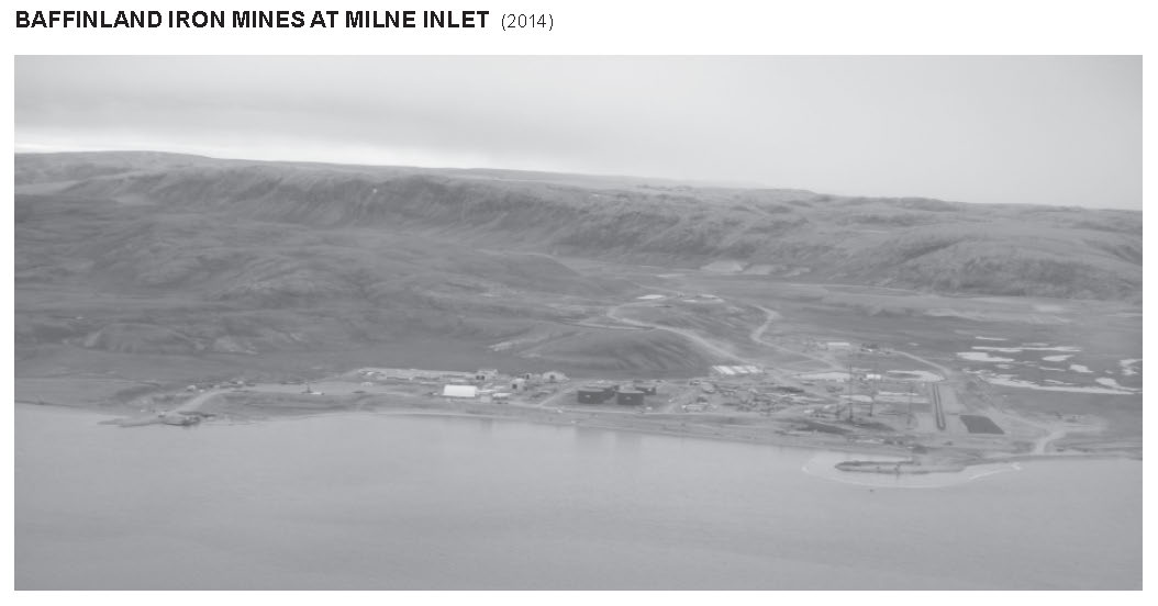
Insert the new Table 4.1 — MILNE INLET ANCHORAGE AREAS and the photograph of BAFFINLAND IRON MINES AT MILNE INLET (2014) that are provided in Section 4 of this Monthly Edition.
Table 4.1: https://www.notmar.gc.ca/publications/monthly-mensuel/images/ed122017-part4-Table%204.1Milne%20Inlet%20Anchorages-en.pdf
Photograph: https://www.notmar.gc.ca/publications/monthly-mensuel/images/ed122017-part4-PhotoBaffinlandMilne%20Inlet-en.jpg
(C2017-009.07)
Chapter 4 — Paragraph 185, after “and Alfred Point”
Insert: (see Anchorage Areas Table)
(C2017-009.08)
INDEX — After “Assistance Islet, C8/P184”
Insert: Assomption Harbour, C4/P179
(C2017-009.09)
PAC 201 — Juan de Fuca Strait and Strait of Georgia, First Edition, 2012 —
Chapter 2 — After paragraph 24
Insert: 24.1 A submarine pipeline (storm water outfall) extends 0.1 mile offshore between Village Rocks and Y Jetty.
(P2017-90.1)
Chapter 2 — Adjacent to paragraph 24.1, add a caution pictograph.
(P2017-90.2)
Chapter 6 — Delete paragraph 268.
(P2017-85.1)
PAC 205 — Inner Passage, Queen Charlotte Sound to Chatham Sound, First Edition, 2002 —
Chapter 2 — After paragraph 448.1
Insert: 448.2 Coste Rocks light (654.4) is shown at an elevation of 39 feet (12 m) from a white tower with a red band on top and bottom.
(P2017-87.1
Chapter 2 — Adjacent to paragraph 448.2, add a light pictograph.
(P2017-87.2
PAC 206 — Hecate Strait, Dixon Entrance, Portland Inlet and Adjacent Waters, and Haida Gwaii, Second Edition, 2015 —
Chapter 1 — After paragraph 70
Insert: 70.1 Wall Islands light (628.5), on the NW side of Wall Islands, is shown at an elevation of 43 feet (13 m) from a white tower fitted with a Racon (— • — •).
(P2017-78.1)
Chapter 1 — Adjacent to paragraph 70.1, add a light pictograph.
(P2017-78.2)
Chapter 1 — After paragraph 254
Insert: 254.1 Kitkatla Islands East light (745.1) , 0.75 mile west of Jock Island, is shown at an elevation of 23 feet (7 m) from a white tower.
(P2017-83.1)
Chapter 1 — Adjacent to paragraph 254.1, add a light pictograph.
(P2017-83.2)
Chapter 1 — After paragraph 271
Insert: 271.1 Kitkatla Islands West light (745.3) , 0.45 mile NE of Browning Island, is shown at an elevation of 23 feet (7 m) from a white tower.
(P2017-84.1)
Chapter 1 — Adjacent to paragraph 271.1, add a light pictograph.
(P2017-84.2)
Chapter 1 — After paragraph 301
Insert: 301.1 Stick Islet light (745.4) , 0.5 mile SE of Grassy Island, is shown at an elevation of 26 feet (8 m) from a white tower with a green band on top.
(P2017-89.1)
Chapter 1 — Adjacent to paragraph 301.1, add a light pictograph.
(P2017-89.2)
Chapter 1 — After paragraph 505
Insert: 501.1 Dougan Point light (631.6), on the east side of Dougan Point, is shown at an elevation of 23 feet (7 m) from a white tower fitted with a green band on top.
(P2017-79.1)
Chapter 1 — Adjacent to paragraph 505.1, add a light pictograph.
(P2017-79.2)
Chapter 1 — After paragraph 521
Insert: 521.1 Fawcett Point light (631.9) is shown at an elevation of 23 feet (7 m) from a white tower.
(P2017-81.1)
Chapter 1 — Adjacent to paragraph 521.1, add a light pictograph.
(P2017-81.2)
Chapter 1 — After paragraph 550
Insert: 550.1 Fernyhough Point light (631.7) is shown at an elevation of 20 feet (6 m) from a white tower with a green band on top.
(P2017-80.1)
Chapter 1 — Adjacent to paragraph 550.1, add a light pictograph.
(P2017-80.2)
Chapter 1 — After paragraph 662
Insert: 662.1 Ralston Island South light (738.7) is shown at an elevation of 30 feet (9 m) from a white tower with a red band on top.
(P2017-88.1)
Chapter 1 — Adjacent to paragraph 662.1, add a light pictograph.
(P2017-88.2)
Chapter 1 — After paragraph 729
Insert: 729.1 Table Hill light (737.1) is shown at an elevation of 26 feet (8 m) from a white tower with a red band on top.
(P2017-86.1)
Chapter 1 — Adjacent to paragraph 729.1, add a light pictograph.
(P2017-86.2)
Chapter 1 — After paragraph 762
Insert: 762.1 Peter Point light (672.5) is shown at an elevation of 23 feet (7 m) from a white tower with a green band on top.
(P2017-82.1)
Chapter 1 — Adjacent to paragraph 762.1, add a light pictograph.
(P2017-82.2)
Chapter 3 — Delete paragraph 182
Replace by: 182 Tatsung Rock, 1 mile south of Yadus Point, is bare and has a shoal between it and shore with a least depth of 7 feet (2.2 m) over it. Close west of Tatsung Rock, an islet, drying, above-and below-water rocks extend 0.3 mile offshore.
(P2017-77.1)
SECTION 5 - LIST OF LIGHTS, BUOYS AND FOG SIGNALS CORRECTIONS
The amendments have been highlighted in yellow.
PACIFIC
| No. | Name | Position ----- Latitude N. Longitude W. |
Light Characteristics |
Focal Height in m. above water |
Nominal Range |
Description ----- Height in meters above ground |
Remarks ----- Fog Signals |
|||
|---|---|---|---|---|---|---|---|---|---|---|
|
75
G5191 | Rugged Islands |
N. point of N. island.
50 19 10.5 127 54 57.9 | Fl | W | 4s | 8.7 | 5 | White square skeleton tower. |
Year round.
Chart:3680 Edn 12/17(P17-102) |
|
|
103
G5216 | Canal Island |
On W. side of island.
49 41 17.1 126 35 09 | Fl | R | 4s | 6.9 | 4 | White square tower, red band at top. |
Year round.
Chart:3675 Edn 12/17(P17-107) |
|
|
103.5
G5216.4 | Salter Point |
49 40 57.3
126 35 13.9 | Q | G | 1s | 7.4 | 4 | White square tower, green band at top. | Visible from 165° through S., W. and N. to 360°. Year round. Chart:3675 Edn 12/17(P17-106) |
|
|
110.3
G5220.4 | Gore Island West |
W. extremity of island.
49 38 56.6 126 26 00.5 | Q | R | 1s | 7.7 | 4 | Visible from 007° through E. and S. to 235°. |
Radar reflector.
Year round. Chart:3675 Edn 12/17 (P17-111) |
|
|
112
G5221.2 | Muchalat Inlet East |
On N. shore of inlet.
49 39 05.0 126 15 46.2 | Fl | G | 4s | 6.3 | 3 | White cylindrical tower, green band at top. |
Radar reflector.
Year round. Chart:3675 Edn 12/17 (P17-112) |
|
|
113
G5222 | Gold River |
W. side of river.
49 40 30.0 126 07 39.2 | Q | G | 1s | 8.3 | 3 | White cylindrical tower, green band at top. | Visible from 198° through W. and N. to 79°. Radar reflector. Year round. Chart:3675 Edn 12/17 (P17-109) |
|
|
210
G5325 | Tuzo Rock |
On rock.
48 25 32.0 123 22 29.8 | Q | G | 1s | 7.2 | 3 | White square tower, green band at top. |
Radar reflector.
Year round. Chart:3412 Edn 12/17 (P17-110) |
|
|
307.1
G5396 | Tsawwassen Ferry Breakwater |
W. end of S. breakwater.
49 00 07.8 123 07 43.0 | Q | R | 1s | 7.8 | 4 | White cylindrical tower, red band at top. | Radar reflector. Year round. Chart:3492 Edn 12/17 (P17-070) |
|
|
353
G5413.3 354 G5413.31 | Tilbury range inbound |
| | | | | | | | | | |
Near N. bank of river.
49 08 54.7 123 02 24 041°10' 273.1m from front. |
Iso
Oc |
Y
Y |
2s
3s |
11.3
19.0 |
15
15 |
On 1-pile dolphin, white daymark, red vertical stripe.
Cylindrical tower, white daymark, red vertical stripe. |
Operates 24 h.
Year round. Flash 2 s; eclipse 1 s. Horizontal and vertical divergence of 3° and 8°, respectively. Operates 24 h. Year round. Chart:3490 Edn 12/17 (P17-072, 073) |
| 628.5 |
Wall Islands Racon -.-. (C) X & S Bnads |
Rennison Island, Caamaño Sound.
052 51 36.9 129 20 50.7 | Fl(3) | W | 12s | 12.6 | 7 | White square tower. |
Flash 1 s; Eclipse 2 s;
Flash 1 s; Eclipse 2 s; Flash 1 s; Eclipse 5 s. Year round. Chart:3982 Edn 12/17 (P17-076) |
|
| 631.6 | Dougan Point |
Campania Island, Campania Sound.
053 02 48.4 129 18 56.5 | Fl | G | 4s | 7.1 | 5 | White square tower, green band at top. | Operates 24 h.
Year round. Chart:3982 Edn 12/17 (P17-079) |
|
|
634
G5736.4 | York Point |
On southern point of peninsula, Gil Island.
53 05 27.5 129 10 29.7 | Q | G | 1s | 8.4 | 4 | White square tower, green band at top. |
Year round.
Chart:3982 Edn 12/17 (P17-078) |
|
| 635
G5736.6 | Borde Island | On northern point of island.
53 05 07.7 129 07 15.2 | Fl | W | 4s | 7.6 | 5 | White square tower. | Year round.
Chart:3911 Edn 12/17(P17-077) |
|
| 651.4 | Stewart Narrows West | North of Otter Shoal. 53 24 06.1 129 16 53.7 |
Q | G | 1s | 3.0 | 2 | Mast, green, white and black square daymark. | Year round. Chart: 3945 Edn 12/17 (P17-071) |
|
|
743
G5751 | Hankin Rock |
On rock, SW. entrance to Beaver Passage.
53 42 27.3 130 24 43.0 | Fl | R | 4s | 10.8 | 5 | Square skeleton tower, red and white rectangular daymark. | Visible 360°. Year round. Chart:3986 Edn 12/17 (P17-075) |
|
|
745
G5753 | Bully Island |
On W. side of island.
53 47 53.3 130 19 33.8 | Fl | W | 6s | 7.4 | 5 | White square tower. |
Flash 0.5 s; eclipse 5.5 s.
Year round. Chart:3985 Edn 12/17 (P17-080) |
|
|
746
G5753.6 | Moore Island |
NW. corner of island.
53 47 23.3 130 31 21.4 | Fl | W | 6s | 7.2 | 4 | White square tower. |
Flash 0.5 s; eclipse 5.5 s.
Year round. Chart:3986 Edn 12/17 (P17-082) |
|
CANADIAN COAST GUARD - MARINE INFORMATION REPORT AND SUGGESTION SHEET
Name of Ship or Sender:..................................................................... Date:....................................
Address of Sender:..........................................................................................................................
Street # Street Name
Town / City:.............................. Prov / State:....................... Postal Code / Zip Code: ........................
Tel / Fax / E-mail address of sender (if appropriate):............................................................................
Observation Date:............................................. Time (UTC): ...........................................................
Geographical Position:......................................................................................................................
Coordinate Position: Lat: ............................................... Long:.........................................................
Position Method: DGPS GPS with WAAS GPS Radar Other
Horizontal Datum Used: WGS 84 NAD 27 Other
Estimated Position Accuracy:............................................................................................................
Chart #:............................................................ Datum: NAD 27 NAD 83
Chart Edition:.................................................... Last Correction applied:............................................
Publications affected: (Quote edition and page number):.....................................................................
*Full details (Attach additional sheets as necessary):...........................................................................
Mariners are requested to notify the responsible authorities when new or suspected dangers to navigation are discovered, changes are observed in aids to navigation, or corrections to publications are seen to be necessary.
In the case of new or suspected dangers to navigation, it is important that all details be given in order to aid with future investigations. Items of interest include heights, depths, physical description, type of bottom and equipment method used to position the item. It is helpful to mark details on the chart, which will be promptly replaced by the Canadian Hydrographic Service.
Reports should be made to the nearest Marine Communications and Traffic Services Centre (MCTS) and should be confirmed in writing to:
Leader, Notices to Mariners
Canadian Coast Guard
Department of Fisheries and Oceans
Montréal, QC H2Y 2E7
In the case of information concerning aids to navigation or the List of Lights, Buoys and Fog Signals book.
OR
Director General, Canadian Hydrographic Service & Oceanographic Services
Department of Fisheries and Oceans
Ottawa, ON K1A 0E6
In the case of new or suspected dangers to navigation or where corrections to "Sailing Directions" appear to be necessary.
For general questions on Canadian Coast Guard programs or services, please send an e-mail to:
info@dfo-mpo.gc.ca (Please include your postal code and e-mail address).
You can access the online form on the following page: https://www.notmar.gc.ca/incident-en.php or you can use the printable pdf version : https://www.notmar.gc.ca/publications/monthly-mensuel/images/monthly-form-en.pdf